

Browse Items (35719 total)
Sort by:
Woman in Long Gown

Photograph of an unidentified woman wearing a long gown and seated on a bench.
Woman in Long Dress and Pearls

Unidentified woman standing in the studio and wearing a long dress and a strand of faux pearls.
Woman in Long Dress and Hat

Unidentified woman wearing an ankle-length dress and wide-brimmed hat.
Woman in Long Dress

Unidentified woman with her hair pulled up and wearing a long dress with a belt, is standing by a chair.
Woman in Long Dress

Unidentified woman wearing a long formal dress with lace tiers and a floral corsage on her belt.
Woman in Long Dress

Unidentified woman with her hair pulled back and wearing a long dress with a lace collar.
Woman in Long Dress

Unidentified woman wearing a long dress with ruffles at the collar.
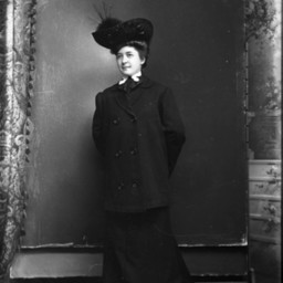
Woman in Long Coat and Hat

Unidentified young woman standing in studio. She is wearing a long coat and a hat with a feather.
Woman in Long Coat and Hat

Unidentified woman is standing by a chair and wearing a long coat and hat with a bow at the back of her head.
Woman in Large Hat
Portrait photograph of an unidentified woman wearing a large, fashionable hat.
Woman in Large Hat
Unidentified woman wearing a large hat decorated with feathers, an overcoat, and a long skirt, is standing with both hands behind her back.
Woman in Large Hat
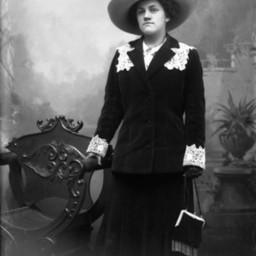
Unidentified woman in a large hat with feathers is standing by a chair and holding a purse.
Woman in Large Hat
Unidentified woman wearing a large hat with feathers and a tie, is seated on a chair.
Woman in Large Hat

Unidentified woman with glassees standing with her hands clasped in front on her and wearing a large wide-brimmed hat, striped overcoat and gloves.
Woman in Large Hat

Portrait photograph of an unidentified young woman wearing a large, wide-brimmed hat.
Woman in Large Hat

Portrait photograph of an unidentified woman wearing a large hat with flowers on it and a bow at the neck of her blouse.
Woman in Large Hat

Unidentified woman wearing a large hat and a tie, is standing by a chair.
Woman in Large Hat

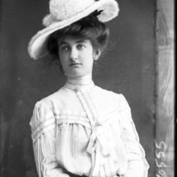
Portrait photograph of an unidentified woman wearing a high-necked dress and a large hat with a feather on it.
Woman in Large Hat

Portrait photograph of an unidentified woman wearing a high-necked dress and large hat with a feather on it.
Woman in Large Hat

Unidentified woman wearing a long coat and large hat.
Woman in Large Hat

Portrait photograph of an unidentified woman, seated, and wearing a large hat.
Woman in Large Hat

Unidentified woman standing in vintage clothes and wearing a large hat.
Woman in Large Hat

Unidentified woman in stylish outfit and wearing a large hat and a watch on a long chain.
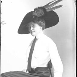
Woman in Large Hat

Unidentified woman wearing a large hat with feathers.
Woman in Large Hat

Photo of a portrait photograph of an unidentified African American woman wearing a long-sleeved blouse and skirt, with a large hat with feathers on her head.