

Browse Items (35719 total)
Sort by:
Wedding Couple

Unidentified groom is seated beside his bride who is standing. Both are wearing their formal wedding attire.
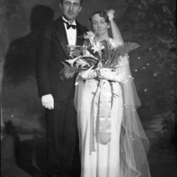
Wedding Couple
Unidentified bride and groom standing together in their wedding attire.
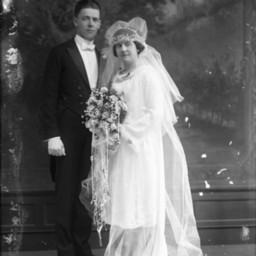
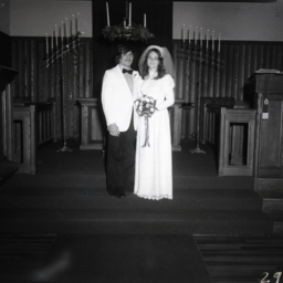
Wedding Couple
Unidentified man in formal wear with white gloves is standing beside an unidentified bride in a veil and holding a large bouquet of flowers.
This was a wedding photograph.
This was a wedding photograph.
Wedding Couple
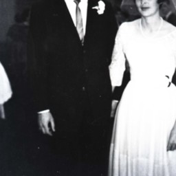
Photo of a snapshot of an unidentified bride and groom standing together.
The original image was probably made the day of their wedding.
The original image was probably made the day of their wedding.
Wedding Couple
Unidentified bride and groom standing on the altar of Emanuel Lutheran Church in Woodstock and wearing their wedding attire.
Wedding Couple
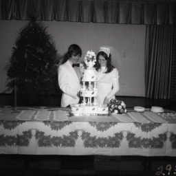
Unidentified bride and groom in their wedding attire standing together behind their multi-tiered wedding cake.
Wedding Couple
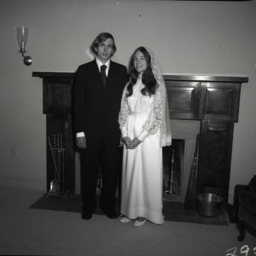
Unidentified bride and groom in their wedding attire are posed standing together in front of a fireplace.
Wedding Couple
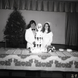
Unidentified bride and groom in their wedding attire standing together behind their multi-tiered wedding cake.
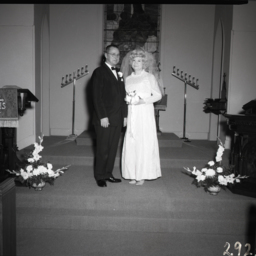
Wedding Couple
Unidentified bride and groom in their wedding attire standing together on the altar of a church.
Wedding Couple
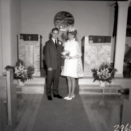
Unidentified man and woman are standing together at the altar of a small church.
The man is wearing a boutonniere and the woman is wearing a short dress and veil. She is holding wedding bouquet.
Possibly, this is a bride and groom.
The man is wearing a boutonniere and the woman is wearing a short dress and veil. She is holding wedding bouquet.
Possibly, this is a bride and groom.
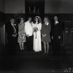
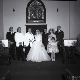
Wedding Couple With Parents
Photograph of an unidentified bride and groom in their wedding attire are standing on the altar of a church and flanked by both sets of parents.
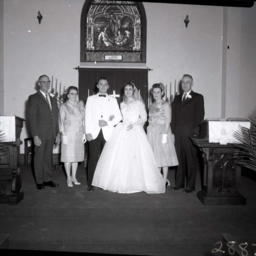
Wedding Couple With Parents
Photograph of an unidentified bride and groom in their wedding attire (center) and flanked by two older unidentified couples, probably their parents.
The photograph is taken on the altar of the church.
The photograph is taken on the altar of the church.
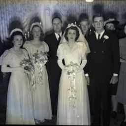
Wedding Couples

Photograph taken by William Hoyle Garber showing two unidentified wedding couples.
Wedding Couples

Photograph taken by William Hoyle Garber showing an unidentified wedding couple exiting a building to a shower of rice.
Wedding of Christine Sager and John Crabill
Photograph showing the wedding of Mary "Christine" (Sager) Crabill and John Crabill.
Pictured are, from left to right:
Front Row: Unidentified, John Crabill, Christine (Sager) Crabill, Betsy (Funk) Sager Fishburn.
Second Row: Unidentified,…
Pictured are, from left to right:
Front Row: Unidentified, John Crabill, Christine (Sager) Crabill, Betsy (Funk) Sager Fishburn.
Second Row: Unidentified,…
Wedding Party
Unidentified members of a wedding party are posed with the bride and groom on the altar of a church.
Wedding Party

Photograph taken by William Hoyle Garber showing an unidentified wedding party.
Wedding Party

Unidentified bride and groom (center) with an unidentified woman on the left (probably the bride's maid of honor) and an unidentified man on the right (probably the groom's best man).
Both women are holding bouquets of flowers. Both men are…
Both women are holding bouquets of flowers. Both men are…
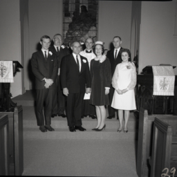
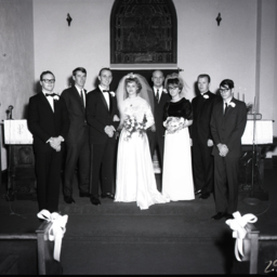
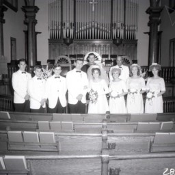
Wedding Party
Unidentified bride and groom in their wedding attire are posed with the rest of the wedding party and the minister on the altar of a church.
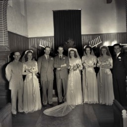
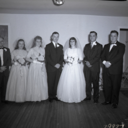
Wedding Party
Group of unidentified people in formal wedding attire are posed standing together.
The bride and groom are at center right. The bride is wearing her wedding veil, dress, and holding a bouquet.
Two bridesmaids are at center left. They are both…
The bride and groom are at center right. The bride is wearing her wedding veil, dress, and holding a bouquet.
Two bridesmaids are at center left. They are both…
Wedding Party

Unidentified bride and groom with the members of their wedding party are posed together on the altar of a church.
Wedding Party
Unidentified members of a wedding party and the minister are posed with the bride and groom on the altar of a church.
Wedding Party
Unidentified bride and groom are standing with members of their wedding party.
Wedding Party
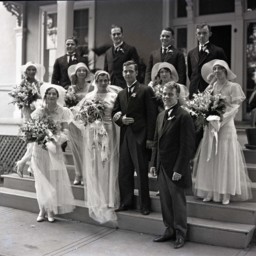
Unidentified bride and groom are pictured with their bridesmaid, best man, and several attendants.
All the women are holding bouquets of flowers and all the men are wearing boutonnieres on their lapels.
The photograph was taken outdoors on the…
All the women are holding bouquets of flowers and all the men are wearing boutonnieres on their lapels.
The photograph was taken outdoors on the…
Wedding Party in Church
Photograph of the unidentified members of a wedding ceremony.
The bride and groom are in the middle with their respective attendants beside them. The unidentified minister and another man, possibly the bride's father, are standing behind…
The bride and groom are in the middle with their respective attendants beside them. The unidentified minister and another man, possibly the bride's father, are standing behind…