

Browse Items (35719 total)
Sort by:
Woman Holding a Baby

Unidentified woman is seated on a bench and holding an unidentified baby in her arms.
Probably, this was a mother and her child.
Probably, this was a mother and her child.
Woman Holding a Baby

Unidentified woman in a sleeveless, print dress is seated outdoors and holding an unidentified baby in her lap.
Woman Holding a Baby

Unidentified woman in a hat is seated and holding an unidentified baby in her arms.
Woman Holding a Baby

Unidentified woman is holding an unidentified baby in her arms.
Probably, this was a mother and her baby.
Probably, this was a mother and her baby.
Woman Holding a Baby

Unidentified woman holding an unidentified baby in her arms.
Probably, this was a mother and her child.
Probably, this was a mother and her child.
Woman Holding a Baby

Unidentified young woman is holding a baby in her arms. The baby's head is resting on the woman's shoulder.
Probably, this was a mother and her child.
Probably, this was a mother and her child.
Woman Holding a Baby

Unidentified young woman standing and holding unidentified baby in long white gown.
Woman Holding a Baby

Unidentified woman holding a baby, both wearing white clothing.
Probably, this was a mother and her child.
Probably, this was a mother and her child.
Woman Holding a Baby

Unidentified woman with her hair pulled back is standing and holding an unidentified barefoot baby in her arms.
Probably, this was a mother and her child.
Probably, this was a mother and her child.
Woman Holding a Baby

Unidentified woman is seated and holding an unidentified baby in her arms.
Probably, this was a mother and her child.
Probably, this was a mother and her child.
Woman From the Side

Unidentified woman with short hair is shown from the side.
Woman from the 19th Century

Photo of a much older photograph of an unidentified woman wearing a dress style reminiscent of the 19th century.
Woman Feeding Deer

Photograph of unidentified woman feeding a doe.
Woman Exiting Car

Photograph of an unidentified woman exiting a car. She is wearing a crown, possibly as a result of a beauty pagent or school event.
Woman Cropped From Group

Photo of a photograph of a group of unidentified people with a woman in the center.
A white outline has been painted around her as though the photographer was planning to make an individual photo of her later.
A white outline has been painted around her as though the photographer was planning to make an individual photo of her later.
Woman Circled in White Paint

Portrait photograph of an unidentified woman whose face, neck, and shoulders have been framed by the photographer with a white marker.
Woman Carrying Portfolio

Unidentified woman with short curled hair is standing in the studio wearing an overcoat and carrying a large portfolio under one arm.
Woman By a Tree
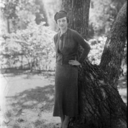
Unidentified woman wearing a hat, skirt, and sweater is standing by a tree outdoors with one hand on her hip.
Woman By a Chair

Unidentified woman with short hair is wearing a jacket over her dress, and standing by a wicker chair.
Woman Beside Child

Photograph of an unidentified woman seated on a chair with a young boy beside her.
Probably, this was a mother and her son.
Probably, this was a mother and her son.
Woman Beside Chair

Photograph of an unidentified woman standing beside a chair in the studio.
Woman Beside a Wicker Chair

Unidentified woman wearing a dress that features a long white scarf hanging down the front, is standing beside a wicker chair.
Woman Beside A Cow

Photo of a photograph of an unidentified woman in a long skirt standing beside a cow in a fenced yard.
Woman Beside a Chair

Unidentified woman standing beside a chair and wearing a dress that almost reaches her ankles.
Woman Beside a Chair

Unidentified woman standing beside a chair in the studio.