

Browse Items (35719 total)
Sort by:
Girl With Short Hair

Portrait photograph of an unidentified girl with short curled hair held with a barrette and wearing a lace collar on her dress.
Girl Standing

Unidentified girl with a bow in her hair is standing by a bench.
Significant emulsion damage is visible on the right side.
Significant emulsion damage is visible on the right side.
Man and Boy
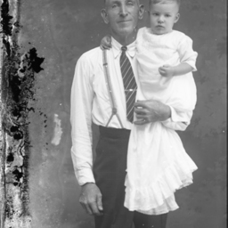
Unidentified older man wearing suspenders and a tie is holding an unidentified young boy.
Probably, these two were related to each other.
Probably, these two were related to each other.
Boy on a Bench
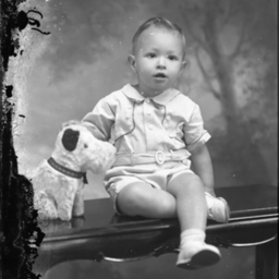
Unidentified young boy is seated on a bench with one leg under the other. A stuffed dog is beside him.
Family Group
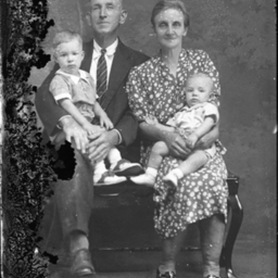
Unidentified man in a suit is seated beside an unidentified woman in a print dress. Two unidentified young boys are posed on their laps.
Probably, this was a family group.
Probably, this was a family group.
Blond Girl Seated

Unidentified blond girl with a bow in her curly hair is seated on a bench with her ankles crossed.
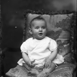
Young Child
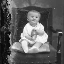
Unidentified young child is seated on a pillow on a chair and holding a toy.
Young Girl and a Doll

Unidentified young girl with bangs is seated on a chair with a doll and holding something in her hand.
Girl With a Doll

Unidentified young girl with bangs is sitting on a chair with her ankles crossed. A doll is on the chair with her.
Mary Ellen (Smith) Etsminger

Photograph of Mary Ellen (Smith) Etsminger in a plaid skirt and standing by a chair.
Mary Ellen was born in Lexington, Virginia, the daughter of Graham and Linda Ann (Engsinger) Smith.
Her family moved to Strasburg when she was young.
She…
Mary Ellen was born in Lexington, Virginia, the daughter of Graham and Linda Ann (Engsinger) Smith.
Her family moved to Strasburg when she was young.
She…
Woman Standing

Unidentified young woman with curly hair parted in the middle and held with barrettes on each side. She is standing by a chair.
Barefoot Toddler

Unidentified barefoot toddler is seated on a chair.
Fishing Champion

Unidentified man in a suit and tie is holding a fishing rod and standing beside a small table with a fishing trophy and another reel on it.
Girl and Toys

Unidentified young girl with a bow in her hair and wearing a print dress, is standing by a chair and toys.
Little Girl With a Toy

Unidentified little girl with short hair and bangs, is standing on a chair and holding a toy.
Woman and Child

Unidentified woman wearing a print dress, is seated in a chair with an unidentified little girl with bangs posed on the chair's arm beside her.
Probably, this was a mother and her child.
Probably, this was a mother and her child.
Twins, Dorothy and Delores Chandler

Photograph of the twin girls, Delores V. and Dorothy A. Chandler, born to Clyde Curtis Chandler and his wife, Anabel Virginia (Artz) Chandler, of Strasburg.
We are unsure which girl is which.
In the 1940 census, the twins lived with their…
We are unsure which girl is which.
In the 1940 census, the twins lived with their…
Boy Holding a Toy

Unidentified boy in a striped shirt is standing by a child-sized chair and holding a toy in his hand.
Girl With Ankles Crossed

Unidentified little girl is seated on a bench with her ankles crossed.
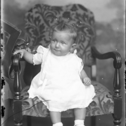
Barefoot Baby on a Chair
Unidentified barefoot young child is seated on a pillow on a chair.
Young Child on a Chair
Unidentified young child is seated on the edge of a chair.
Baby on a Chair
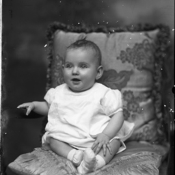
Unidentified young child is seated on pillows on a chair.
Girl on a Chair
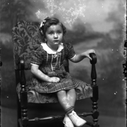
Unidentified girl with a bow in her hair and wearing a plaid dress, is seated on a chair with her ankles crossed.
Family Photograph
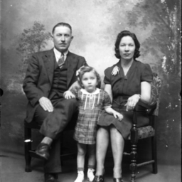
Unidentified man and woman, seated together, with an unidentified little girl in a plaid dress standing between them.
Probably, this was a family photograph.
Probably, this was a family photograph.
Man in a Wicker Chair
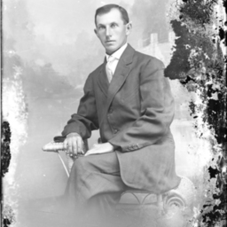
Unidentified man in a suit and tie is seated on a wicker chair.