

Browse Items (45 total)
Sort by:
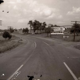
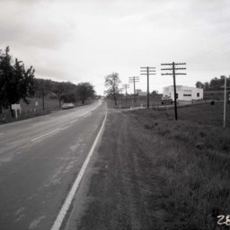
View of Route 11 - Woodstock
Photograph showing the view looking south from the intersection of US Route 11 (now Main Street) and Fairground Road in Woodstock Virginia.
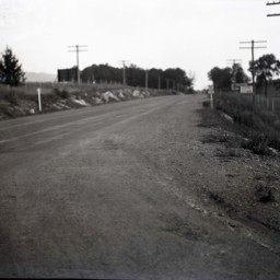
View of Route 11 - Woodstock
Photograph showing the view looking north from the intersection of US Route 11 (now Main Street) and Fairground Road in Woodstock Virginia.
Wrecked Vehicle Beside Route 11
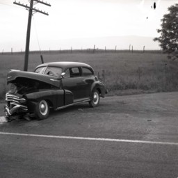
Photograph of a wrecked car on the side of Route 11 south of Woodstock.
View Along Route 11 North of Strasburg
View looking north along Route 11 just north of Strasburg, Virginia.
Vintage automobiles are parked on the right side of the road. A historical marker stands between the two cars and is titled, "Fort Bowman".
An Esso station advertising cabins,…
Vintage automobiles are parked on the right side of the road. A historical marker stands between the two cars and is titled, "Fort Bowman".
An Esso station advertising cabins,…
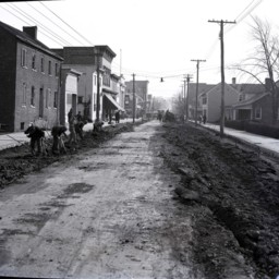
Men Repaving King Street in Strasburg
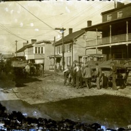
Damaged image of unidentified men with shovels digging up King Street in Strasburg in preparation for its repaving.
Early trucks are seen with the men. The truck on the right of the image has a sign on the side that reads, "Virginia Department of…
Early trucks are seen with the men. The truck on the right of the image has a sign on the side that reads, "Virginia Department of…
View Along King Street in Strasburg
View looking east along King Street (Route 11) in Strasburg, Virginia.
First Bank is visible on the left as is the Virginia Restaurant across Holliday Street.
Vintage automobiles are parked on both sides of the street.
This photograph was…
First Bank is visible on the left as is the Virginia Restaurant across Holliday Street.
Vintage automobiles are parked on both sides of the street.
This photograph was…
View Along Route 11 North of Strasburg
View looking north along Route 11 just north of Strasburg, Virginia.
Vintage automobiles are parked on the right side of the road. A historical marker stands between the two cars and is titled, "Fort Bowman".
An unidentified man holding his hat…
Vintage automobiles are parked on the right side of the road. A historical marker stands between the two cars and is titled, "Fort Bowman".
An unidentified man holding his hat…
Route 11 Between Edinburg and Woodstock
View of Route 11 from south of Woodstock and looking south towards Edinburg.
A sign on the left advertises the Chrysler Plymouth business 2 miles ahead in Edinburg. A mailbox and turnout are visible on the right side of the road.
Debris from…
A sign on the left advertises the Chrysler Plymouth business 2 miles ahead in Edinburg. A mailbox and turnout are visible on the right side of the road.
Debris from…
King Street in Strasburg
View of King Street looking east in Strasburg, Virginia. The photograph was taken on King Street about halfway down the block east of Fort Street towards Holliday Street.
Unidentified men are working on the road with hand tools in the foreground.…
Unidentified men are working on the road with hand tools in the foreground.…
Old Shenandoah County Courthouse
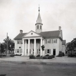
Photograph of the old Shenandoah County Courthouse located on the northwest corner of Court and Main Streets in Woodstock, and taken from across Main Street (U.S. Route 11).
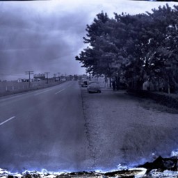
View of Main Street in Woodstock
View looking north down Main Street (U.S. Highway 11) in Woodstock, Virginia.
The image was made at the intersection of S. Main and South Streets.
The image was made at the intersection of S. Main and South Streets.
Traffic Accident Between Edinburg and Woodstock
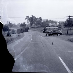
Traffic accident involving a car and truck. A damaged sedan and an overturned truck trailer litter the road. Skid marks are also visible.
The photograph was taken on Route 11 from north of Edinburg and looking north towards Woodstock.
Signs on…
The photograph was taken on Route 11 from north of Edinburg and looking north towards Woodstock.
Signs on…
Wrecked Truck Trailor Beside Route 11
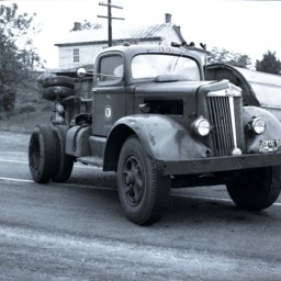
Photograph of an overturned trailer on the side of Route 11 south of Woodstock.
The words, "Mason and Dixon" are printed on the side of the trailer. The truck that was pulling the trailer is on the road and has Tennessee license plates and the…
The words, "Mason and Dixon" are printed on the side of the trailer. The truck that was pulling the trailer is on the road and has Tennessee license plates and the…
Wrecked Vehicle Beside Route 11
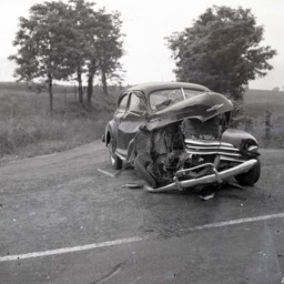
Photograph of a wrecked car on the side of Route 11 south of Woodstock.
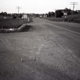
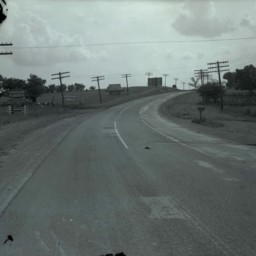
Route 11 Between Edinburg and Woodstock
View of Route 11 from north of Edinburg and looking north towards Woodstock.
Signs on the right side of the road advertise The Hotel Woodstock (3 miles) and the Woodstock Garage (4 miles).
Telephone poles line both sides of the road.
Signs on the right side of the road advertise The Hotel Woodstock (3 miles) and the Woodstock Garage (4 miles).
Telephone poles line both sides of the road.
Rt 11 at Saumsville Road
View looking north on U.S. Route 11 near the intersection with Saumsville Road north of Woodstock.
The large brick home on the left side of the road (center of image) belonged to Jonathan Stribling Crabill.
A large white barn is on the…
The large brick home on the left side of the road (center of image) belonged to Jonathan Stribling Crabill.
A large white barn is on the…
Rt 11 at Saumsville Road
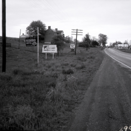
View looking north on U.S. Route 11 near the intersection with Saumsville Road north of Woodstock.
Signs for the Alexander Hotel in Hagerstown, Shenandoah Apple Candy, and the Clearbrook Woolen Shop are also visible on the left side of the…
Signs for the Alexander Hotel in Hagerstown, Shenandoah Apple Candy, and the Clearbrook Woolen Shop are also visible on the left side of the…
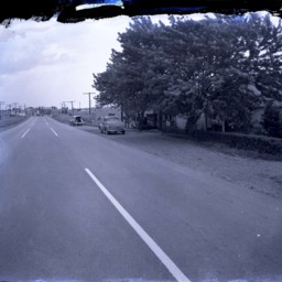
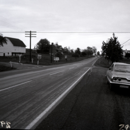
South End of New Market
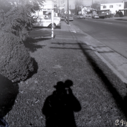
View along Route 11 at the south end of New Market.
The Moyers Ford dealership on the left is advertising 1963 Fords and the photographer's shadow is visible in the foreground.
The Moyers Ford dealership on the left is advertising 1963 Fords and the photographer's shadow is visible in the foreground.
Irvin Inc. Building - Edinburg
Photograph of the building that housed Irvin Inc., a wholesale distribution facility also known as the Irvin Candy Company.
Irvin Incorporated was established by George E. Irvin, and his business partner, J.I. Triplett, in 1884, as a farm…
Irvin Incorporated was established by George E. Irvin, and his business partner, J.I. Triplett, in 1884, as a farm…
Main Street, Woodstock
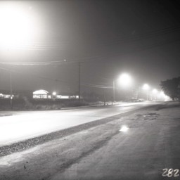
Nighttime photograph of Woodstock Shopping Center, located at the north end of Woodstock. At the time, it was anchored by a Safeway Store.
U.S. Route 11 runs in front of it and several street lamps illuminate the way into town.
U.S. Route 11 runs in front of it and several street lamps illuminate the way into town.
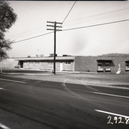
Route 11 and Bowers Taxidermy
View looking south down U.S. Route 11 at the intersection with Saumsville Road north of Woodstock.
Bowers Taxidermy business, operated by Jimmy Bowers for more than 60 years, is visible on the right where "Deer Heads Mounted" is advertised on the…
Bowers Taxidermy business, operated by Jimmy Bowers for more than 60 years, is visible on the right where "Deer Heads Mounted" is advertised on the…
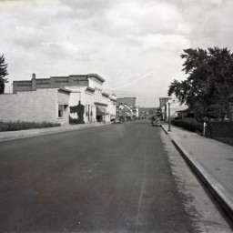
View of Main Street, New Market
View looking down Main Street (U.S. Route 11) in New Market, Virginia.
Buildings and telephone poles/wires are visible on both sides of the street.
A corner of the parking lot for a Sinclair gas station is visible on the right.
Buildings and telephone poles/wires are visible on both sides of the street.
A corner of the parking lot for a Sinclair gas station is visible on the right.
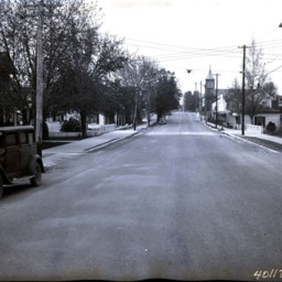
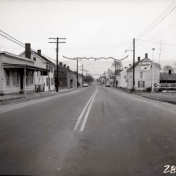
Main Street, New Market
View looking south on Main Street (U.S. Route 11) in New Market, Virginia.
The photograph was taken in winter. Houses, buildings, and vehicles are visible on both sides of the street.
The photograph was taken in winter. Houses, buildings, and vehicles are visible on both sides of the street.
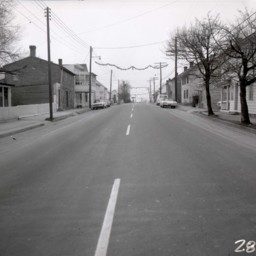
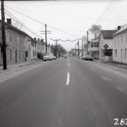
Main Street, New Market

View looking south on Main Street in New Market, Virginia.
The photograph was taken in winter. Houses, buildings, and vehicles are visible on both sides of the street.
The photograph was taken in winter. Houses, buildings, and vehicles are visible on both sides of the street.