

Browse Items (74 total)
Sort by:
House on Main Street, Toms Brook
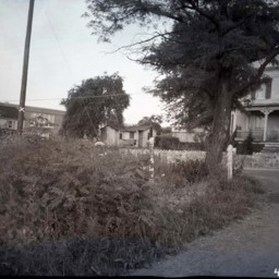
View of a two-story home with a covered front porch and a border stone wall fronting on Main Street (U.S. Route 11) in Toms Brook, Virginia.
The photograph was taken from across Route 11 standing on Creek Road. Today's Handy-Mart would be on the…
The photograph was taken from across Route 11 standing on Creek Road. Today's Handy-Mart would be on the…
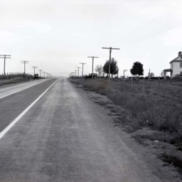
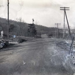
House Near Rude's Hill
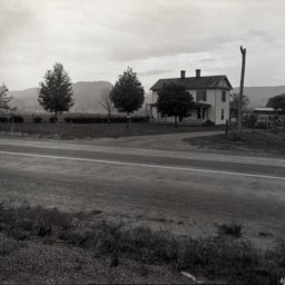
View looking across U.S. Route 11 at a two-story farmhouse and outbuildings located just south of Mount Jackson, on Rude's Hill near Caverns Road.
The house still stands (as of 2025) at 5168 Old Valley Pike.
The house still stands (as of 2025) at 5168 Old Valley Pike.
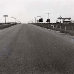
House and Outbuildings Near Rude's Hill
View looking across U.S. Route 11 at a two-story farmhouse and outbuildings located just south of Mount Jackson, on Rude's Hill near Caverns Road.
The house still stands (as of 2025) at 5168 Old Valley Pike.
The house still stands (as of 2025) at 5168 Old Valley Pike.
House Near Rude's Hill
View looking across U.S. Route 11 at a two-story farmhouse and outbuildings located just south of Mount Jackson, on Rude's Hill near Caverns Road.
The house still stands (as of 2025) at 5168 Old Valley Pike.
The house still stands (as of 2025) at 5168 Old Valley Pike.
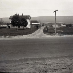
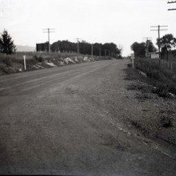
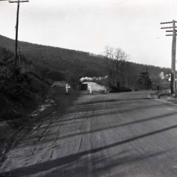
House Near Rude's Hill
View along Route 11 just south of Mount Jackson, on Rude's Hill.
A two-story farmhouse visible on the right is near Caverns Road.
The house still stands (as of 2025) at 5168 Old Valley Pike.
A two-story farmhouse visible on the right is near Caverns Road.
The house still stands (as of 2025) at 5168 Old Valley Pike.
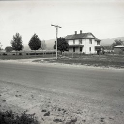
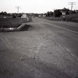
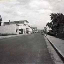
View of Route 11 - Woodstock
Photograph showing the view looking south from the intersection of US Route 11 (now Main Street) and Fairground Road in Woodstock Virginia.
View of Route 11 - Woodstock
Photograph showing the view looking north from the intersection of US Route 11 (now Main Street) and Fairground Road in Woodstock Virginia.
Route 55 East of Strasburg
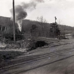
Photograph showing a portion of US Route 55.
This portion is located east of Strasburg Virginia near the foot of the Massanutten Mountain. The road was later rerouted to avoid the railroad crossing pictured here.
A steam engine is headed…
This portion is located east of Strasburg Virginia near the foot of the Massanutten Mountain. The road was later rerouted to avoid the railroad crossing pictured here.
A steam engine is headed…
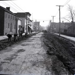
Men Repaving King Street in Strasburg
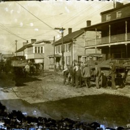
Damaged image of unidentified men with shovels digging up King Street in Strasburg in preparation for its repaving.
Early trucks are seen with the men. The truck on the right of the image has a sign on the side that reads, "Virginia Department of…
Early trucks are seen with the men. The truck on the right of the image has a sign on the side that reads, "Virginia Department of…
Route 55 East of Strasburg

Photograph showing a portion of US Route 55 under construction.
This portion is located east of Strasburg Virginia near the foot of the Massanutten Mountain.
A sign straight ahead indicates with an arrow that traffic should use the old road…
This portion is located east of Strasburg Virginia near the foot of the Massanutten Mountain.
A sign straight ahead indicates with an arrow that traffic should use the old road…
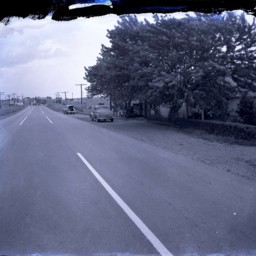
View Along King Street in Strasburg
View looking east along King Street (Route 11) in Strasburg, Virginia.
First Bank is visible on the left as is the Virginia Restaurant across Holliday Street.
Vintage automobiles are parked on both sides of the street.
This photograph was…
First Bank is visible on the left as is the Virginia Restaurant across Holliday Street.
Vintage automobiles are parked on both sides of the street.
This photograph was…
Route 55 East of Strasburg
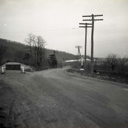
Photograph showing a portion of US Route 55 under construction.
This portion is located east of Strasburg Virginia near the foot of the Massanutten Mountain.
A sign straight ahead indicates with an arrow that traffic should use the old road…
This portion is located east of Strasburg Virginia near the foot of the Massanutten Mountain.
A sign straight ahead indicates with an arrow that traffic should use the old road…
Route 55 East of Strasburg
Photograph showing a portion of US Route 55..
This portion is located east of Strasburg Virginia near the foot of the Massanutten Mountain. The road was later rerouted to avoid this crossing.
Telephone poles line both sides of the road.
This portion is located east of Strasburg Virginia near the foot of the Massanutten Mountain. The road was later rerouted to avoid this crossing.
Telephone poles line both sides of the road.
View Along Route 11 North of Strasburg
View looking north along Route 11 just north of Strasburg, Virginia.
Vintage automobiles are parked on the right side of the road. A historical marker stands between the two cars and is titled, "Fort Bowman".
An unidentified man holding his hat…
Vintage automobiles are parked on the right side of the road. A historical marker stands between the two cars and is titled, "Fort Bowman".
An unidentified man holding his hat…
Route 55 East of Strasburg
Photograph showing a portion of US Route 55 under construction.
This portion is located east of Strasburg Virginia near the foot of the Massanutten Mountain.
A sign straight ahead indicates with an arrow that traffic should use the old road…
This portion is located east of Strasburg Virginia near the foot of the Massanutten Mountain.
A sign straight ahead indicates with an arrow that traffic should use the old road…
Fairground Road Looking East
View taken from Old Route 42 (now called Fairground Road) in Woodstock, Virginia.
The image is looking east towards Grabill's Manufacturing Plant visible in the background.
In 2013, the site was used by Shaffer's.
The image is looking east towards Grabill's Manufacturing Plant visible in the background.
In 2013, the site was used by Shaffer's.
View Near Woodstock Virginia
Photograph showing a passenger train and view of the Massanutten Mountain near Woodstock Virginia.
The road visible is today called Fairground Road and US Route 11 is visible in the mid-ground of the image.
The large brick house still stands…
The road visible is today called Fairground Road and US Route 11 is visible in the mid-ground of the image.
The large brick house still stands…
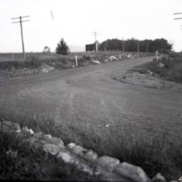
Route 11 Between Edinburg and Woodstock
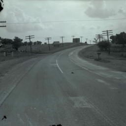
View of Route 11 from south of Woodstock and looking south towards Edinburg.
A sign on the left advertises the Chrysler Plymouth business 2 miles ahead in Edinburg. A mailbox and turnout are visible on the right side of the road.
Debris from…
A sign on the left advertises the Chrysler Plymouth business 2 miles ahead in Edinburg. A mailbox and turnout are visible on the right side of the road.
Debris from…
King Street in Strasburg
View of King Street looking east in Strasburg, Virginia. The photograph was taken on King Street about halfway down the block east of Fort Street towards Holliday Street.
Unidentified men are working on the road with hand tools in the foreground.…
Unidentified men are working on the road with hand tools in the foreground.…
Traffic Accident Between Edinburg and Woodstock
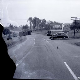
Traffic accident involving a car and truck. A damaged sedan and an overturned truck trailer litter the road. Skid marks are also visible.
The photograph was taken on Route 11 from north of Edinburg and looking north towards Woodstock.
Signs on…
The photograph was taken on Route 11 from north of Edinburg and looking north towards Woodstock.
Signs on…
View of Mount Jackson
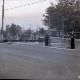
View of Main Street in Mount Jackson Virginia, where it intersects with Orkney Blvd.
The photograph was taken from behind two gas pumps and beside a cemetery.
The photograph was taken from behind two gas pumps and beside a cemetery.
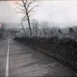
View Across a Road and Railroad Tracks
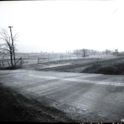
Photograph of an unidentified paved road as it crosses railroad tracks.
Beyond both, only fields, bare trees, fences, and a couple of telephone poles are visible.
Beyond both, only fields, bare trees, fences, and a couple of telephone poles are visible.
View of Route 11 - Woodstock
Photograph showing the view looking south from the intersection of US Route 11 (now Main Street) and Fairground Road in Woodstock Virginia.
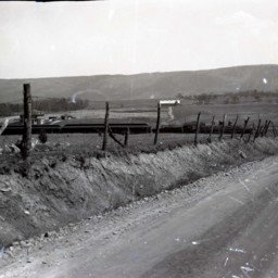
View Near Jerome
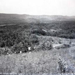
Photograph showing a view of Shenandoah County near the Jerome community.
Great North Mountain and Falls Ridge are visible in this image.
An unpaved road partially obscured by trees and a wood fence is visible across the lower portion of the…
Great North Mountain and Falls Ridge are visible in this image.
An unpaved road partially obscured by trees and a wood fence is visible across the lower portion of the…