

Browse Items (97 total)
Sort by:
Farm
View across a pasture to a farmhouse and many outbuildings around it.
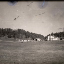
Farms Near Bowmans Crossing
Photograph showing farms and houses near the Bowmans Crossing community.
The image looks west and is today home of the 277 interchange for Interstate 81. This would have been known as the Bowman and Richman Farms.
The image looks west and is today home of the 277 interchange for Interstate 81. This would have been known as the Bowman and Richman Farms.
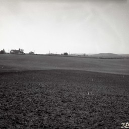
Farms Near Bowmans Crossing
Photograph showing farms and homes near Bowmans Crossing Virginia.
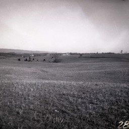
Farms Near Bowmans Crossing
Photograph showing farms near the Bowmans Crossing community looking east toward the Massanutten Mountain.
The Interstate 81 277 Interchange is today located in the center of this photograph. Structures in Bowmans Crossing along Route 11 are…
The Interstate 81 277 Interchange is today located in the center of this photograph. Structures in Bowmans Crossing along Route 11 are…
Gochenour Farm
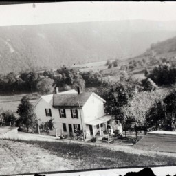
Photograph showing the Gochenour Farm located along the Shenandoah River north east of Woodstock Virginia. This house is located at 1432 Helsley Bridge Road.
Two unidentified people are visible on the porch.
The photographer was standing on a…
Two unidentified people are visible on the porch.
The photographer was standing on a…
Agricultural Building
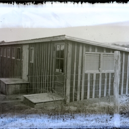
Unidentified agricultural building with a row of high windows along the top left and a door leading into it. Perhaps this portion of the building was used to house chickens.
Another door leads into the right side of the building.
At the far…
Another door leads into the right side of the building.
At the far…
Man on Buggy in Farm Field

View across a field. There is an unidentified man in a straw boater sitting in a horse-drawn carriage and buildings in the distance.
J.H. Tisinger Farm - Barn and Animals

Photograph of the barn, silos, animals, and hay of the J.H. Tisinger Farm in Mount Jackson, Virginia.
An unidentified man is visible on the lower left near the horse-drawn cart.
An unidentified man is visible on the lower left near the horse-drawn cart.
Belgravia Farm

Photo of a photograph showing Belgravia Farm near Mount Jackson Virginia.
The farm's large horse barn, destroyed by fire in 2023, is visible on the left side of the image as is the Massanutten Mountain which is visible in the background.
The farm's large horse barn, destroyed by fire in 2023, is visible on the left side of the image as is the Massanutten Mountain which is visible in the background.
"The Tavenner & Gravely Peach Orchard"

Large group of unidentified men and women shown at various tasks at a fruit processing site. Crates and containers are visible.
The words, "The Tavenner & Gravely Peach Orchard", and the place, "Woodstock, Va." are written on the bottom of the…
The words, "The Tavenner & Gravely Peach Orchard", and the place, "Woodstock, Va." are written on the bottom of the…
R.A. Wilkins' Sunnyside Farm

Photograph of Rufus Albert (R.A.) Wilkins, his wife Emeline (Helsley) Wilkins, and other family members with a cow and her twin calves in the foreground at “Sunnyside Farm” dated July 20, 1910.
Rufus Albert Wilkins owned and worked this farm on…
Rufus Albert Wilkins owned and worked this farm on…
Woman With Cow and Calf

Unidentified woman is standing with her cow and calf. A farmhouse and outbuildings are visible behind her.
Cows Eating Grass

Photograph of four cows eating grass. There is a vehicle and two farm buildings also visible in the picture.
Oscar Hottel's Farm Near Woodstock

Photograph of the Oscar Hottel farm located 2 miles east of Woodstock near Reservoir Road.
Pictured left to right are: Allie (Feagans) Hottel, her daughter Helen (Hottel) Fahnestock, Allie's husband Charles Hottel, and their son, W. Jacob…
Pictured left to right are: Allie (Feagans) Hottel, her daughter Helen (Hottel) Fahnestock, Allie's husband Charles Hottel, and their son, W. Jacob…
Hand Well With Bucket

Photograph of a well with a bucket and rope/hand cranking system for retrieving water. A small roof overhead protects the water as well.
Stout Farm

Photo of a photograph of the "Stout Farm" (local name based on the family that was associated with the farm for many years) with a house, barn, and multiple other buildings. The Shenandoah River is in the foreground and the Massanutten Mountain is in…
Farm Workers

Photograph of a group of unidentified farm workers standing around two horses pulling a piece of farm equipment.
In addition to the men in farm clothes, there is a man wearing a suit as well as a man with a cook's apron holding a large pan and…
In addition to the men in farm clothes, there is a man wearing a suit as well as a man with a cook's apron holding a large pan and…
Oscar Hottel's Farm Near Woodstock

Oscar Hottel farm located 2 miles east of Woodstock near Reservoir Road.
Pictured left to right are: Allie (Feagans) Hottel, her husband, Charles Hottel, their daughter, Helen (Hottel) Fahnestock, and their son, W. Jacob Hottel.
Some of the…
Pictured left to right are: Allie (Feagans) Hottel, her husband, Charles Hottel, their daughter, Helen (Hottel) Fahnestock, and their son, W. Jacob Hottel.
Some of the…
Farm Near Maurertown

Panorama of a farm house on a knob with various barns and outbuildings around it.
The farm was located on Headley Road, along the North Fork of the Shenandoah River, and east of Maurertown.
The farm was located on Headley Road, along the North Fork of the Shenandoah River, and east of Maurertown.
Bushong Farm

Photograph of the Bushong Farm located in the New Market Battlefield State Historical Park north of New Market, Virginia. The Federal-styled home was built in 1825 to accommodate Jacob Bushong and Sarah Strickler's growing family.
The 1864…
The 1864…
Farm in the Valley

Panoramic shot of an unidentified farm house surrounded by outbuildings and the scenic Shenandoah Valley.
Plate shows emulsion damage.
Plate shows emulsion damage.
Farm With Numerous Outbuildings

Image of several unidentified farm buildings taken from across a field.
Home of Harold Morrison Sr. and Loise Morrison

Photograph of Harold Morrison, Sr., his wife Loise Ambrose Morrison, and their dog, Brownie, sitting on the porch of their home.
The structure was located on U.S. Route 11, east of Pugh's Run.
Harold Morrison was the son of Hugh Morrison, Jr.,…
The structure was located on U.S. Route 11, east of Pugh's Run.
Harold Morrison was the son of Hugh Morrison, Jr.,…
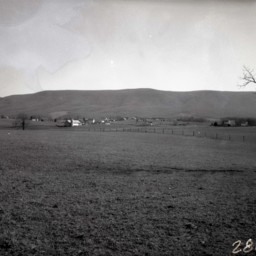
Farm on a Hill

Photograph of an unidentified rural farmhouse and barn set against a mountain backdrop.
Valley Farm and Landscape

Photo of a photograph of unidentified farm buildings with hilly terrain and mountains in the background.