

Browse Items (106 total)
Sort by:
"Massanutten Mountain, Strasburg, VA."

Photograph of the Massanutten Mountain and a portion of the Town of Strasburg Virginia.
The picture appears to have been taken from an airplane and is labeled "Aerial Photo Made Exclusively for Massanutten National Bank by Robinson Studio, Front…
The picture appears to have been taken from an airplane and is labeled "Aerial Photo Made Exclusively for Massanutten National Bank by Robinson Studio, Front…
View of Signal Knob Mountain Near Strasburg
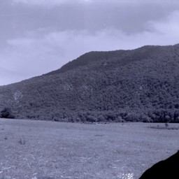
View of Signal Knob Mountain located in Strasburg, Virginia.
Signal Knob, Near Strasburg, Virginia
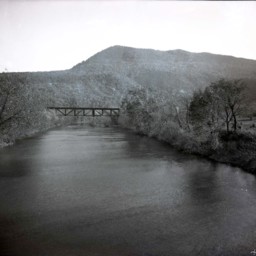
Photograph of the Shenandoah River, railroad bridge. and Massanutten Mountain's Signal Knob near Strasburg Virginia.
The photograph was taken from the Route 55 Highway bridge just east of Strasburg.
The railroad bridge runs close to the…
The photograph was taken from the Route 55 Highway bridge just east of Strasburg.
The railroad bridge runs close to the…
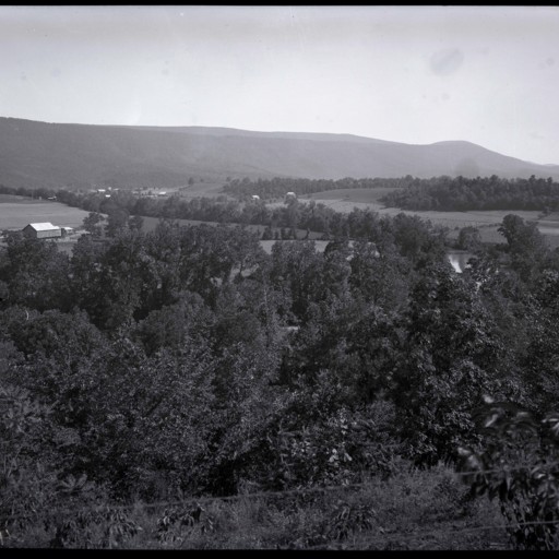
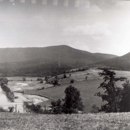
Valley View - Maurertown
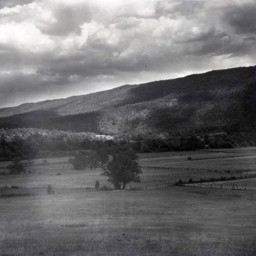
Photograph showing farm, barn, and view of the Massanutten Mountain east of Maurertown Virginia.
The barn pictured on the right still stands at 989 Black Bear Road, Maurertown.
The barn pictured on the right still stands at 989 Black Bear Road, Maurertown.
View Near Woodstock Virginia
Photograph showing a passenger train and view of the Massanutten Mountain near Woodstock Virginia.
The road visible is today called Fairground Road and US Route 11 is visible in the mid-ground of the image.
The large brick house still stands…
The road visible is today called Fairground Road and US Route 11 is visible in the mid-ground of the image.
The large brick house still stands…
View Looking East of Woodstock and MMA Campus
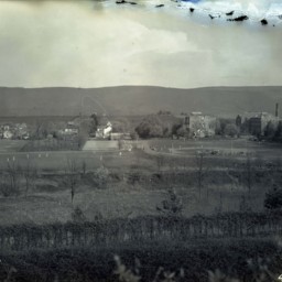
View looking east from Massanutten Heights, of the ball fields and campus buildings of Massanutten Military Academy (MMA).
Route 11 runs on the far side of the buildings and many houses on the southern end of Woodstock are also visible.
Several…
Route 11 runs on the far side of the buildings and many houses on the southern end of Woodstock are also visible.
Several…
View of Camp Lupton
Photograph showing Camp Lupton, a recreational camp operated by Massanutten Academy just west of Woodstock Virginia.
The image shows the camp, river, and a view of the Massanutten Mountain. Camp buildings and tents are visible in the center of…
The image shows the camp, river, and a view of the Massanutten Mountain. Camp buildings and tents are visible in the center of…
View Near Edinburg
A view of a rural area north east of Edinburg Virginia. The Edinburg Gap in the Massanutten Mountain and the Shenandoah River are both visible.
A large barn is visible in the distance.
This image was originally scanned in reverse and corrected…
A large barn is visible in the distance.
This image was originally scanned in reverse and corrected…
View Near Jerome
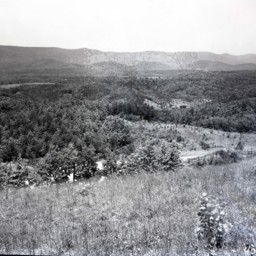
Photograph showing a view of Shenandoah County near the Jerome community.
Great North Mountain and Falls Ridge are visible in this image.
An unpaved road partially obscured by trees and a wood fence is visible across the lower portion of the…
Great North Mountain and Falls Ridge are visible in this image.
An unpaved road partially obscured by trees and a wood fence is visible across the lower portion of the…
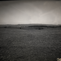
Valley View
View looking across the Shenandoah Valley towards mountains.
Trees in the foreground are possibly part of a fruit tree orchard.
Trees in the foreground are possibly part of a fruit tree orchard.
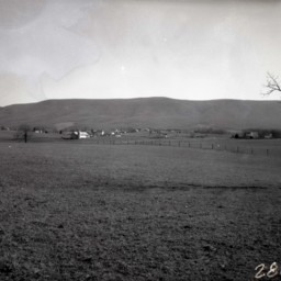
Valley View - Basye
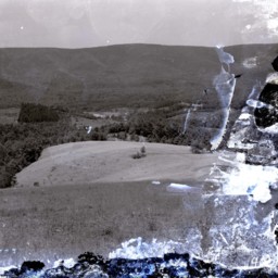
Damaged image showing a view of the area in western Shenandoah County known as the Happy Valley/Basye community.
Trinity/Powder Springs United Church of Christ and Powder Springs School are visible on a hill close to the center of the photograph…
Trinity/Powder Springs United Church of Christ and Powder Springs School are visible on a hill close to the center of the photograph…
Senedo Road and Hisey Avenue - Woodstock Virginia
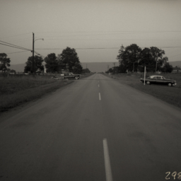
Photograph showing Route 42 on the western edge of Woodstock Virginia.
The photograph looks east toward Woodstock. It was taken at the intersection of what is now Reservoir Road and Hisey Avenue.
Two automobiles are also visible.
The photograph looks east toward Woodstock. It was taken at the intersection of what is now Reservoir Road and Hisey Avenue.
Two automobiles are also visible.
View near Edinburg Virginia
Photograph showing a mountain view in the area of what is now the 12000 block of S. Middle Road, Edinburg Virginia.
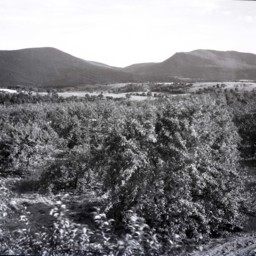
Scenic View of an Orchard
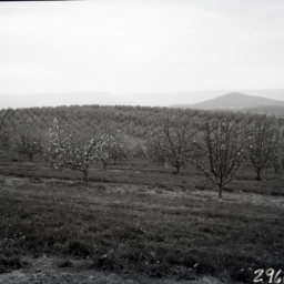
View across rolling fruit tree orchards. Mountains are visible in the distance.
Scenic View
View looking east from a country road somewhere west of Massanutten Mountain.
Scenic View of Orchards
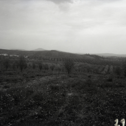
View across rolling fruit tree orchards. Individual mountains and farms are visible in the distance.
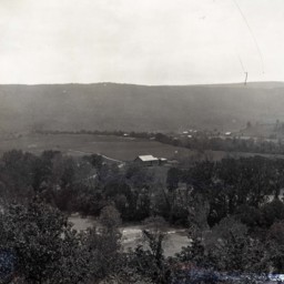
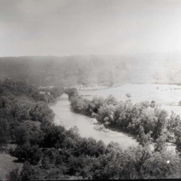
View of Seven Bends
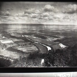
View looking southwest across the Seven Bends area of the North Fork of the Shenandoah River near Woodstock.
Scenic View
View of the Shenandoah River and Massanutten Mountain near Edinburg Virginia.
The photograph looks west from near Route 11 and overlooks the Edinburg Dam on the North Fork of the Shenandoah River. The Cliffside Estates development (Cliffside…
The photograph looks west from near Route 11 and overlooks the Edinburg Dam on the North Fork of the Shenandoah River. The Cliffside Estates development (Cliffside…
"Lewis Funkhouser's Ford"
Photograph showing the "Ford at Lewis Funkhouser's" with the Massanutten Mountain in the background.
The site is currently occupied by the Lupton Road River Bridge with Seven Bends State Park on the right of the image. Woodstock is immediately…
The site is currently occupied by the Lupton Road River Bridge with Seven Bends State Park on the right of the image. Woodstock is immediately…
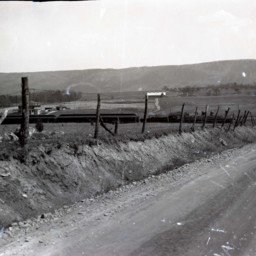
Farms Near Bowmans Crossing
Photograph showing farms near the Bowmans Crossing community looking east toward the Massanutten Mountain.
The Interstate 81 277 Interchange is today located in the center of this photograph. Structures in Bowmans Crossing along Route 11 are…
The Interstate 81 277 Interchange is today located in the center of this photograph. Structures in Bowmans Crossing along Route 11 are…
Horseback Riders at Camp Strawderman
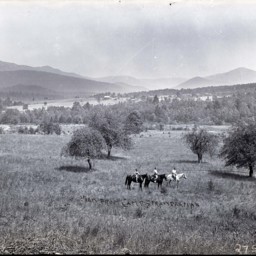
Three unidentified people on horseback are visible with the panoramic view from Camp Strawderman behind them.
Gochenour Farm
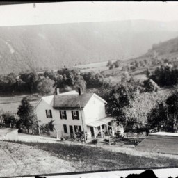
Photograph showing the Gochenour Farm located along the Shenandoah River north east of Woodstock Virginia. This house is located at 1432 Helsley Bridge Road.
Two unidentified people are visible on the porch.
The photographer was standing on a…
Two unidentified people are visible on the porch.
The photographer was standing on a…
Rural View

View of a county road heading down a narrow valley.
A 1920's era automobile is visible on the road and a house is on the right. Mountains are also visible.
A 1920's era automobile is visible on the road and a house is on the right. Mountains are also visible.
Valley View

View looking down a hill and toward mountains in the distance. Rows of planted trees are visible on the left.
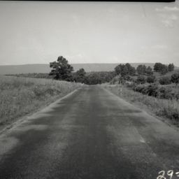
Road and Mountains

Unidentified road leading towards a tree-covered mountain. A wood fence is visible in the foreground.