

Browse Items (95 total)
Sort by:
Signal Knob, Near Strasburg, Virginia
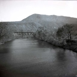
Photograph of the Shenandoah River, railroad bridge. and Massanutten Mountain's Signal Knob near Strasburg Virginia.
The photograph was taken from the Route 55 Highway bridge just east of Strasburg.
The railroad bridge runs close to the…
The photograph was taken from the Route 55 Highway bridge just east of Strasburg.
The railroad bridge runs close to the…
View of Camp Lupton
Photograph showing Camp Lupton, a recreational camp operated by Massanutten Academy just west of Woodstock Virginia.
The image shows the camp, river, and a view of the Massanutten Mountain. Camp buildings and tents are visible in the center of…
The image shows the camp, river, and a view of the Massanutten Mountain. Camp buildings and tents are visible in the center of…
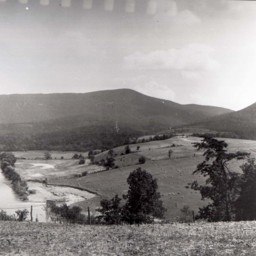
View of Seven Bends
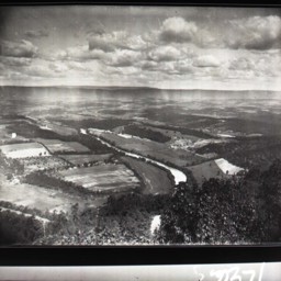
View looking southwest across the Seven Bends area of the North Fork of the Shenandoah River near Woodstock.
View of Seven Bends
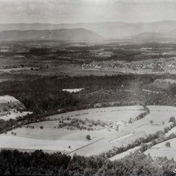
View of the Shenandoah Valley taken from above the area of the Shenandoah River known as Seven Bends and looking west towards the town of Woodstock and the mountains beyond it.
Scenic View
View of the Shenandoah River and Massanutten Mountain near Edinburg Virginia.
The photograph looks west from near Route 11 and overlooks the Edinburg Dam on the North Fork of the Shenandoah River. The Cliffside Estates development (Cliffside…
The photograph looks west from near Route 11 and overlooks the Edinburg Dam on the North Fork of the Shenandoah River. The Cliffside Estates development (Cliffside…
"Lewis Funkhouser's Ford"
Photograph showing the "Ford at Lewis Funkhouser's" with the Massanutten Mountain in the background.
The site is currently occupied by the Lupton Road River Bridge with Seven Bends State Park on the right of the image. Woodstock is immediately…
The site is currently occupied by the Lupton Road River Bridge with Seven Bends State Park on the right of the image. Woodstock is immediately…
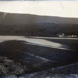
Flooded Area
Photograph showing an unidentified flooded river (most likely the Shenandoah River).
A power house and flooded dam spanning the river are visible.
A power house and flooded dam spanning the river are visible.
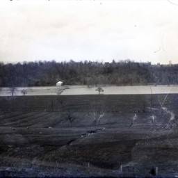
Flooded Area Near Burnshire Dam
Photograph of a flooded farm field.
A barn, house, and other structures are visible in the picture.
The location of this site is unknown, but it may be near Woodstock Virginia.
A barn, house, and other structures are visible in the picture.
The location of this site is unknown, but it may be near Woodstock Virginia.
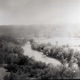
River View

View of a peaceful river as it approaches a bend. Both banks are tree-lined.
Road Along A River

Photograph of a dirt road located above and along a stretch of river.
An unidentified man is standing at the base of the telephone pole. A house and power lines are also visible.
An unidentified man is standing at the base of the telephone pole. A house and power lines are also visible.
River Bend

Photograph of a peaceful spot on a river bend with trees on both banks.
Shenandoah River and Stricklers Knob

Photograph showing the Shenandoah River and Strickler's Knob in Page County near Luray Virginia.
Shenandoah River near Riverton

Photograph showing the concrete dam spanning the Shenandoah River near the community of Riverton in Warren County Virginia.
Riverton is visible on the left of the image.
Riverton is visible on the left of the image.
Shenandoah River

Photograph showing a portion of the North Fork of the Shenandoah River with a swinging pedestrian bridge crossing the water in the foreground.
Boy on the River

Unidentified boy is sitting in a small, clam-shell shaped boat on an unidentified river.
Scenic River Spot

View west towards "The Knob" near Mount Jackson and from beside a creek or river. Farm buildings are visible on the left side.
Shallow Spot on the River

Photograph overlooking a shallow spot on a river, probably the Shenandoah. A sand bar and ripples are visible in the scene.
River View

View of a river, probably the Shenandoah, as it approaches a bend. Mountains are in the distance. Right bank is cleared and three rows of hay or straw stacks can be seen.
Canoe on the Shenandoah River

Photograph of a lone unidentified man canoeing in what appears to be the North Fork of the Shenandoah River.
Railroad Bridge and Signal Knob, Near Strasburg

Photograph of the Shenandoah River, railroad bridge. and Massanutten Mountain's Signal Knob near Strasburg Virginia.
The photograph was taken from the Route 55 Highway bridge just east of Strasburg.
The photograph was taken from the Route 55 Highway bridge just east of Strasburg.
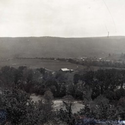
Shenandoah River, ca. 1930

Four (4) photographs showing the Shenandoah River just east of Woodstock Virginia.
Three (3) of the images show the river's "Seven Bends" from the area of what is now the Woodstock Tower. The fourth was taken from what is now Frenchs Woods Road…
Three (3) of the images show the river's "Seven Bends" from the area of what is now the Woodstock Tower. The fourth was taken from what is now Frenchs Woods Road…
Shenandoah River Flooding at Red Banks

Photograph showing a flooded bridge across the North Fork of the Shenandoah River at Red Banks in Shenandoah County. Three unidentified people are standing in the foreground.
Letter from S.D. Crude to J.W. Garner

Letter from S.D. Crude, resident engineer for the Virginia Department of Highways, to J.W. Garner of the Shenandoah County Board of Supervisors. The letter informs Garner and the board that the state department of transportation had received approval…
Swimmers at Red Banks
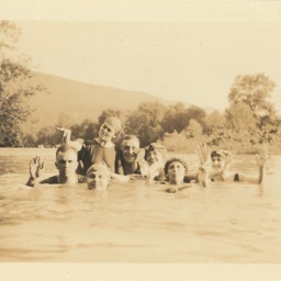
Photograph showing an unidentified group of men and women swimming in the Shenandoah River at Red Banks, just north of Mt. Jackson.
Unidentified Group of Women

Photograph showing a group of nine unidentified women. It is part of a group of photographs from a camping trip to Red Banks along the Shenandoah River. It was conducted by the Edinburg "XYZ Club."