

Browse Items (97 total)
Sort by:
"France Brother Milk D.H."

Photograph of the French Brothers Dairy located on Water Street in Woodstock Virginia.
The image is labeled by the producer "France Brother Milk D.H."
It is dated 1980.
The image is labeled by the producer "France Brother Milk D.H."
It is dated 1980.
Farm and Vegetable Garden - Page County
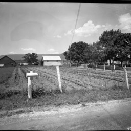
Photograph taken from a road looking across a vegetable garden neatly planted in rows. A house is on the right with shade trees in front of it. A barn and other farm buildings are beyond the field.
This garden is located at the intersection of…
This garden is located at the intersection of…
Chickens Inside a Chicken House
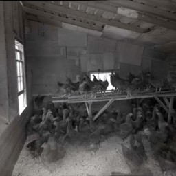
Photograph of chickens taken from inside of a chicken house.
Two windows are cracked open on the left.
This chicken house was located in Page County Virginia.
Two windows are cracked open on the left.
This chicken house was located in Page County Virginia.
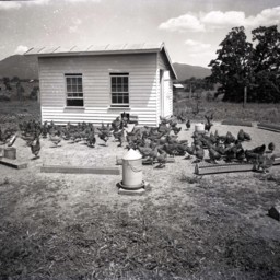
Chickens
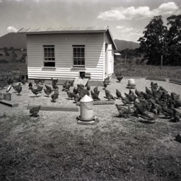
Photograph of chickens outdoors and scratching around in front of a chicken house.
This house was located in Page County Virginia. Duncan's Knob is visible in the background.
This house was located in Page County Virginia. Duncan's Knob is visible in the background.
Several Dead Deer Hung on a Line
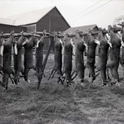
Photograph of several dead deer, all males with varying sized antlers, strung upside down on a sturdy wood frame.
The photograph was taken on the farm of Alfred Gochenour, located at Back and Fairview Roads, west of Woodstock.
The photograph was taken on the farm of Alfred Gochenour, located at Back and Fairview Roads, west of Woodstock.
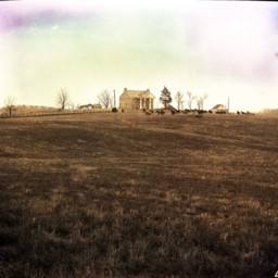
Valley View - Maurertown
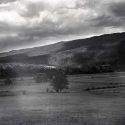
Photograph showing farm, barn, and view of the Massanutten Mountain east of Maurertown Virginia.
The barn pictured on the right still stands at 989 Black Bear Road, Maurertown.
The barn pictured on the right still stands at 989 Black Bear Road, Maurertown.
Montvue Farm - Warren County Virginia
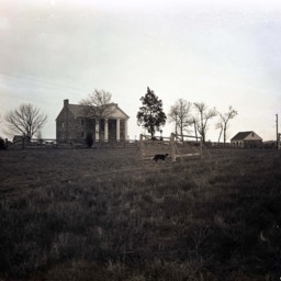
Photograph showing Montvue Farms in Warren County Virginia.
The house, dating to the first half of the 20th century and surrounding outbuildings along with several unidentified men and a sheep dog, possible in training o a competition.
The house, dating to the first half of the 20th century and surrounding outbuildings along with several unidentified men and a sheep dog, possible in training o a competition.
Chickens
Photograph of chickens outdoors and scratching around in front of a chicken house.
This house was located in Page County Virginia. Duncan's Knob is visible in the background.
This house was located in Page County Virginia. Duncan's Knob is visible in the background.
Chickens Inside a Chicken House
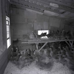
Photograph of chickens taken from inside of a chicken house.
The chickens were moving when the image was made and many are blurred.
This chicken house was located in Page County Virginia.
The chickens were moving when the image was made and many are blurred.
This chicken house was located in Page County Virginia.
Montvue Farm - Warren County Virginia
Photograph showing Montvue Farms in Warren County Virginia.
The house, dating to the first half of the 20th century, surrounding outbuildings, and horses are visible.
The house, dating to the first half of the 20th century, surrounding outbuildings, and horses are visible.
Farmer and Boy in a Field
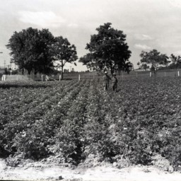
Photograph of an unidentified farmer wearing overalls and a hat is standing beside an unidentified boy in a large field planted in a knee-high, flowering crop.
View of Dellinger and Funkhouser Farms
Photograph showing a wheat harvest on the Dellinger/Funkhouser farms located east of Woodstock Virginia.
Several farm workers and machinery are visible in the center of the image. The house which still stands at 1205 Lupton Road is visible in the…
Several farm workers and machinery are visible in the center of the image. The house which still stands at 1205 Lupton Road is visible in the…
Man and Boy in a Wheat Field
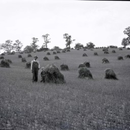
Unidentified farmer with a hat and overalls is standing by a young unidentified boy with curly hair in a field of cut wheat.
Behind them is another man atop a horse-drawn cart loaded with wheat.
This may be located on the Clower Farm near…
Behind them is another man atop a horse-drawn cart loaded with wheat.
This may be located on the Clower Farm near…
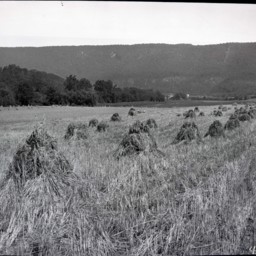
Wheat Field and Farm
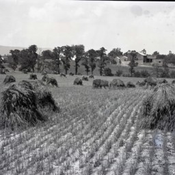
View across a wheat field that has been cut and put in piles awaiting further processing.
The picture shows the Clower farm located near Saumsville Virginia.
The house visible on the left still stands at 1292 Jadwyn Road and the house in the…
The picture shows the Clower farm located near Saumsville Virginia.
The house visible on the left still stands at 1292 Jadwyn Road and the house in the…
Men Working on a Barn Roof
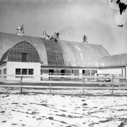
Photograph of several unidentified men working on the roof of a large barn.
It appears they are putting a new roof on it.
There is snow on the ground.
It appears they are putting a new roof on it.
There is snow on the ground.
Farms Near Bowmans Crossing

Photograph showing farms near the Bowmans Crossing community looking east toward the Massanutten Mountain.
The Interstate 81 277 Interchange is today located in the center of this photograph. Structures in Bowmans Crossing, including the railroad…
The Interstate 81 277 Interchange is today located in the center of this photograph. Structures in Bowmans Crossing, including the railroad…
Barn Interior
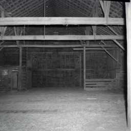
Photograph of the interior of a large barn.
This barn was originally located on S. Middle Road just west of Bowmans Crossing. During the construction of Interstate 81 it was relocated to behind 13460 S. Middle Road to make way for the 277…
This barn was originally located on S. Middle Road just west of Bowmans Crossing. During the construction of Interstate 81 it was relocated to behind 13460 S. Middle Road to make way for the 277…
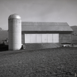
Large Barn and Silo
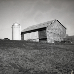
Photograph of a large barn, and silo with rolling hills and fields around it.
This barn was originally located on S. Middle Road just west of Bowmans Crossing. During the construction of Interstate 81 it was relocated to behind 13460 S. Middle…
This barn was originally located on S. Middle Road just west of Bowmans Crossing. During the construction of Interstate 81 it was relocated to behind 13460 S. Middle…
Large Barn and Silo
Photograph of a large barn, and silo with rolling hills and fields around it.
This barn was originally located on S. Middle Road just west of Bowmans Crossing. During the construction of Interstate 81 it was relocated to behind 13460 S. Middle…
This barn was originally located on S. Middle Road just west of Bowmans Crossing. During the construction of Interstate 81 it was relocated to behind 13460 S. Middle…
Interior of a Barn
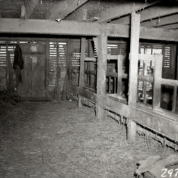
Interior view of a barn. Dirt floor and wooden rafters and supports are visible.
This barn was originally located on S. Middle Road just west of Bowmans Crossing. During the construction of Interstate 81 it was relocated to behind 13460 S. Middle…
This barn was originally located on S. Middle Road just west of Bowmans Crossing. During the construction of Interstate 81 it was relocated to behind 13460 S. Middle…
View Along Lower Back Side of Barn
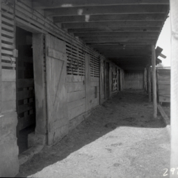
View along the lower back side of a large barn.
This barn was originally located on S. Middle Road just west of Bowmans Crossing. During the construction of Interstate 81 it was relocated to behind 13460 S. Middle Road to make way for the 277…
This barn was originally located on S. Middle Road just west of Bowmans Crossing. During the construction of Interstate 81 it was relocated to behind 13460 S. Middle Road to make way for the 277…
Interior of a Barn
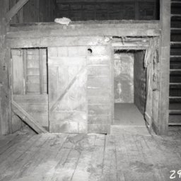
Interior view of a portion of a barn showing a storage space and a ladder on the right.
This barn was originally located on S. Middle Road just west of Bowmans Crossing. During the construction of Interstate 81 it was relocated to behind 13460 S.…
This barn was originally located on S. Middle Road just west of Bowmans Crossing. During the construction of Interstate 81 it was relocated to behind 13460 S.…
Barn and Automobile
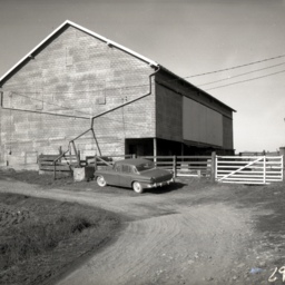
Photograph of a large barn with a vehicle parked in front of it. Fencing and a dirt driveway are also visible.
This barn was originally located on S. Middle Road just west of Bowmans Crossing. During the construction of Interstate 81 it was…
This barn was originally located on S. Middle Road just west of Bowmans Crossing. During the construction of Interstate 81 it was…
Scenic View of an Orchard
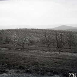
View across rolling fruit tree orchards. Mountains are visible in the distance.
Scenic View of Orchards
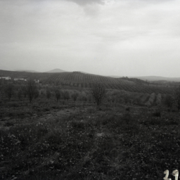
View across rolling fruit tree orchards. Individual mountains and farms are visible in the distance.