

Browse Items (10 total)
Sort by:
View of Dellinger and Funkhouser Farms
Photograph showing a wheat harvest on the Dellinger/Funkhouser farms located east of Woodstock Virginia.
Several farm workers and machinery are visible in the center of the image. The house which still stands at 1205 Lupton Road is visible in the…
Several farm workers and machinery are visible in the center of the image. The house which still stands at 1205 Lupton Road is visible in the…
View Across Wheat Field Towards St. Luke
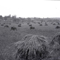
View of the village of St. Luke (west of Woodstock) from across a field of cut wheat.
The home place of W.B. Foltz is visible in the back left.
The home place of W.B. Foltz is visible in the back left.
Man and Boy in a Wheat Field
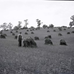
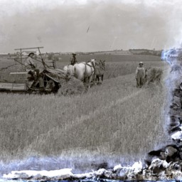
Unidentified farmer with a hat and overalls is standing by a young unidentified boy with curly hair in a field of cut wheat.
Behind them is another man atop a horse-drawn cart loaded with wheat.
This may be located on the Clower Farm near…
Behind them is another man atop a horse-drawn cart loaded with wheat.
This may be located on the Clower Farm near…
Wheat Field and Farm
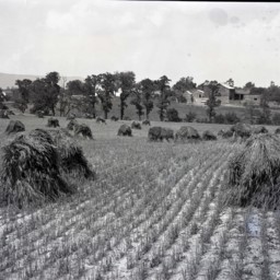
View across a wheat field that has been cut and put in piles awaiting further processing.
The picture shows the Clower farm located near Saumsville Virginia.
The house visible on the left still stands at 1292 Jadwyn Road and the house in the…
The picture shows the Clower farm located near Saumsville Virginia.
The house visible on the left still stands at 1292 Jadwyn Road and the house in the…
Binding Wheat
Photograph of unidentified men using horse drawn harvesting equipment to bind wheat.
The photograph was taken at Meems Bottom, in the area near Mt. Airy Farm, just south of Mount Jackson and east of Route 11.
The photograph was taken at Meems Bottom, in the area near Mt. Airy Farm, just south of Mount Jackson and east of Route 11.
Eldoe (Smoot) Wheat

Photo of two separate portrait photographs of Eldoe Eve (Smoot) Wheat with short hair and glasses.
Eldoe was born in Mount Jackson, the eldest daughter of Lester Randolph and Glenna (Myers) Smoot.
Eldo left Mount Jackson to work in Washington,…
Eldoe was born in Mount Jackson, the eldest daughter of Lester Randolph and Glenna (Myers) Smoot.
Eldo left Mount Jackson to work in Washington,…
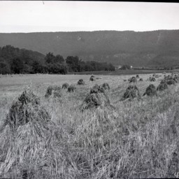
Field of Bound Wheat

View across a field dotted with piles of bound wheat.
The photograph was taken at Meems Bottom, in the area near Mt. Airy Farm, just south of Mount Jackson and east of Route 11.
The photograph was taken at Meems Bottom, in the area near Mt. Airy Farm, just south of Mount Jackson and east of Route 11.
Binding Wheat

Photograph of unidentified men using horse drawn harvesting equipment including reaper-binder machines to bind wheat.
The photograph was taken at Meems Bottom, in the area near Mt. Airy Farm, just south of Mount Jackson and east of Route 11.
The photograph was taken at Meems Bottom, in the area near Mt. Airy Farm, just south of Mount Jackson and east of Route 11.
B.E. Nelson Wheat Field

Postcard showing B.E. Nelson's wheat field.