Browse Items (63 total)
- Tags: Farms
Farm on the River
Tags: Farms, Houses, Shenandoah County, Virginia
Hand Well With Bucket
Tags: Farms, Shenandoah County, Virginia
Oscar Hottel's Farm Near Woodstock
Pictured left to right are: Allie Feagans Hottel, her husband, Charles Hottel, their daughter, Helen Hottel Fahnestock, and their son, W. Jacob Hottel.
Some of the…
Tags: Fahnestock, Family, Farms, Feagans, Hottel, Shenandoah County, Virginia
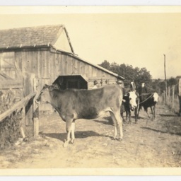
Cows Eating Grass
Tags: Cattle, Farms, Shenandoah County, Virginia
R.A. Wilkins' Sunnyside Farm
Rufus Albert Wilkins owned and worked this farm on…
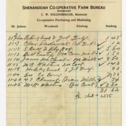
Edinburg Hatchery Statement
Tags: Edinburg, Farms, Shenandoah County, Virginia
Mt. Airy Farm
Tags: Farms, Meems Bottom, Mt. Jackson, Postcards, Virginia
"Meem's Bottom" on Route 11 along the Scenic Shenandoah Valley, Va.
The view looks north from the area of Rude's Hill, a geographic feature located between Mt. Jackson and New Market. The house and barn on the left of the image still stand (as of 2023)…
Tags: Farms, Meems Bottom, Mt. Jackson, Postcards, Route 11, Shenandoah County, Virginia
Men Harvesting with Steam Traction Engine
The photograph is undated. A label in the left hand corner bearing the word "Engine" followed by an illegible second word is…
Tags: Agriculture, Farms, Shenandoah County, Virginia
Walter Boyd on his Tractor
This photograph is labeled:
Granddaddy Walter and his Tractor
Picture Boyd taken…
Tags: Farms, Shenandoah County, Tractor, Virginia
The Picturesque Shenandoah River with Fishers Hill Battle Ground in the Distance, near Strasburg Va.
The view looks north toward Strasburg Virginia. The card was produced in 1911.
Loading Express, Oct. 1914
The photograph is dated October 1914. The boys are unidentified. Most likely the image was taken at the Toms Brook railroad depot, but that…
Tags: Agriculture, Depots, Farms, Produce, Railroads, Shenandoah County, Virginia
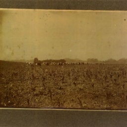
Horses in a Field
Tags: Agriculture, Animals, Farms, Horses, Shenandoah County, Virginia
Two Men in a Corn Field
Tags: Agriculture, Farms, Shenandoah County, Unidentified, Virginia
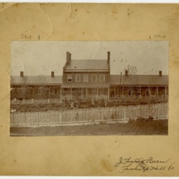
Shenandoah County Alms House
Tags: Farms, Government, Poverty, Shenandoah County, Virginia
John Paul Williams Farm
Tags: Farms, Shenandoah County, Unidentified, Vehicle, Virginia
Farm Work
Based on the date of a related image, these photographs most likely date to ca. 1916.
Tags: Agriculture, Farms, Horses, Shenandoah County, Virginia
Unidentified Men with Foal
On the back of the photograph, someone wrote the number 4.
Tags: Agriculture, Animals, Farms, Horses, Men
Unidentified Farm
Tags: Farms
Tisinger Farm
Tags: Farms, Mt. Jackson, Shenandoah County, Tisinger, Virginia


