
Browse Items (31227 total)
- Collection: Morrison Studio Collection
Sort by:
View Along King Street in Strasburg
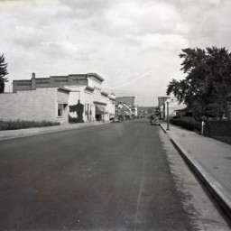
View looking east along King Street (Route 11) in Strasburg, Virginia.
First Bank is visible on the left as is the Virginia Restaurant across Holliday Street.
Vintage automobiles are parked on both sides of the street.
This photograph was…
First Bank is visible on the left as is the Virginia Restaurant across Holliday Street.
Vintage automobiles are parked on both sides of the street.
This photograph was…
View Along Lower Back Side of Barn
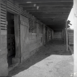
View along the lower back side of a large barn.
This barn was originally located on S. Middle Road just west of Bowmans Crossing. During the construction of Interstate 81 it was relocated to behind 13460 S. Middle Road to make way for the 277…
This barn was originally located on S. Middle Road just west of Bowmans Crossing. During the construction of Interstate 81 it was relocated to behind 13460 S. Middle Road to make way for the 277…
View Along Route 11 North of Strasburg
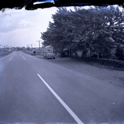
View looking north along Route 11 just north of Strasburg, Virginia.
Vintage automobiles are parked on the right side of the road. A historical marker stands between the two cars and is titled, "Fort Bowman".
An unidentified man holding his hat…
Vintage automobiles are parked on the right side of the road. A historical marker stands between the two cars and is titled, "Fort Bowman".
An unidentified man holding his hat…
View Along Route 11 North of Strasburg
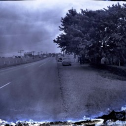
View looking north along Route 11 just north of Strasburg, Virginia.
Vintage automobiles are parked on the right side of the road. A historical marker stands between the two cars and is titled, "Fort Bowman".
An Esso station advertising cabins,…
Vintage automobiles are parked on the right side of the road. A historical marker stands between the two cars and is titled, "Fort Bowman".
An Esso station advertising cabins,…
View along the Valley Turnpike

Photograph of the view along the Valley Turnpike (now US Route 11) just North of New Market Virginia.
The roadway is visible center left of the image as is the 54th Pennsylvania Volunteer Infantry monument present on the New Market battlefield…
The roadway is visible center left of the image as is the 54th Pennsylvania Volunteer Infantry monument present on the New Market battlefield…
View from MMA Grounds

View from the lawn of Massanutten Military Academy (MMA) looking east over the stone wall and across Route 11 to two large houses, one of which is surrounded by a picket fence.
View Looking East of Woodstock and MMA Campus
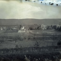
View looking east from Massanutten Heights, of the ball fields and campus buildings of Massanutten Military Academy (MMA).
Route 11 runs on the far side of the buildings and many houses on the southern end of Woodstock are also visible.
Several…
Route 11 runs on the far side of the buildings and many houses on the southern end of Woodstock are also visible.
Several…
View looking East on Route 7, Clarke County

Photograph taken east of Berryville, Virginia, looking east on Route 7 towards Snickers Gap. Mountains are visible in the distance and agricultural fields are on both sides of the road.
View Near Edinburg
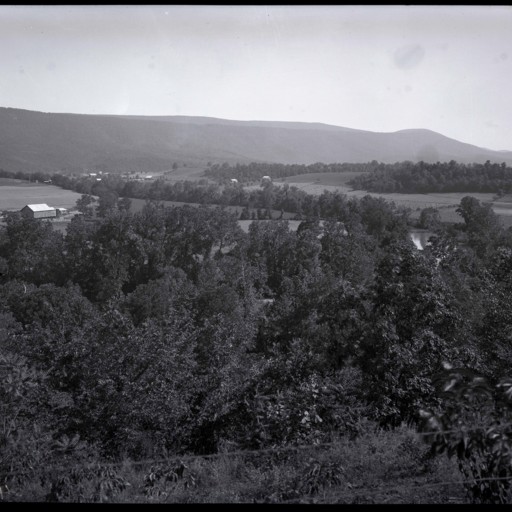
A view of a rural area north east of Edinburg Virginia. The Edinburg Gap in the Massanutten Mountain and the Shenandoah River are both visible.
A large barn is visible in the distance.
This image was originally scanned in reverse and corrected…
A large barn is visible in the distance.
This image was originally scanned in reverse and corrected…
View near Edinburg Virginia
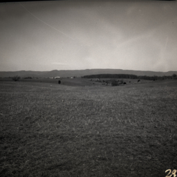
Photograph showing a mountain view in the area of what is now the 12000 block of S. Middle Road, Edinburg Virginia.
View Near Jerome
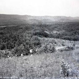
Photograph showing a view of Shenandoah County near the Jerome community.
Great North Mountain and Falls Ridge are visible in this image.
An unpaved road partially obscured by trees and a wood fence is visible across the lower portion of the…
Great North Mountain and Falls Ridge are visible in this image.
An unpaved road partially obscured by trees and a wood fence is visible across the lower portion of the…
View Near Woodstock Virginia
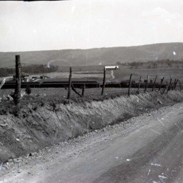
Photograph showing a passenger train and view of the Massanutten Mountain near Woodstock Virginia.
The road visible is today called Fairground Road and US Route 11 is visible in the mid-ground of the image.
The large brick house still stands…
The road visible is today called Fairground Road and US Route 11 is visible in the mid-ground of the image.
The large brick house still stands…
View of a Pasture

View looking up an inclined pasture. There are cedar trees visible along the ridge. Natural stone and and a feed trough are visible in the foreground.
View of Camp Lupton
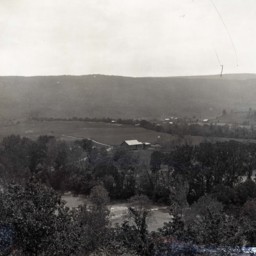
Photograph showing Camp Lupton, a recreational camp operated by Massanutten Academy just west of Woodstock Virginia.
The image shows the camp, river, and a view of the Massanutten Mountain. Camp buildings and tents are visible in the center of…
The image shows the camp, river, and a view of the Massanutten Mountain. Camp buildings and tents are visible in the center of…
View of Camp Strawderman

Photograph overlooking mountains and buildings belonging to Camp Strawderman near Edinburg, Virginia.
View of Camp Strawderman
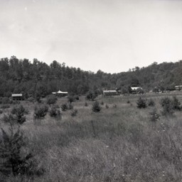
View of many of the buildings belonging to Camp Strawderman near Edinburg.
View of Countryside and Endless Caverns
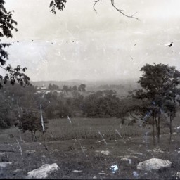
View of a wide expanse of the Shenandoah Valley across fields and trees.
In the background, you can see the entrance to and parking lot for Endless Caverns near New Market Virginia.
In the background, you can see the entrance to and parking lot for Endless Caverns near New Market Virginia.
View of Court and Main Streets in Woodstock

View of central Woodstock looking north along Main Street (Route 11) and featuring the intersection with Court Street.
The old courthouse is also featured and there is a crowd of men milling about on the sidewalk in front of it.
The old courthouse is also featured and there is a crowd of men milling about on the sidewalk in front of it.
View of Dellinger and Funkhouser Farms
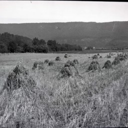
Photograph showing a wheat harvest on the Dellinger/Funkhouser farms located east of Woodstock Virginia.
Several farm workers and machinery are visible in the center of the image. The house which still stands at 1205 Lupton Road is visible in the…
Several farm workers and machinery are visible in the center of the image. The house which still stands at 1205 Lupton Road is visible in the…
View of Liberty Iron Furnace
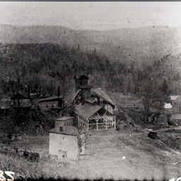
Photo of a photograph of buildings that were part of the Liberty Iron Furnace.
Liberty Furnace was located along Stony Creek approximately 11 miles west of Edinburg, Virginia.
Liberty Furnace was located along Stony Creek approximately 11 miles west of Edinburg, Virginia.
View of Main Street in Woodstock
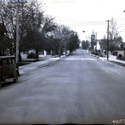
View looking north down Main Street (U.S. Highway 11) in Woodstock, Virginia.
The image was made at the intersection of S. Main and South Streets.
The image was made at the intersection of S. Main and South Streets.
View of Main Street, New Market
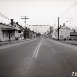
View looking down Main Street (U.S. Route 11) in New Market, Virginia.
Buildings and telephone poles/wires are visible on both sides of the street.
A corner of the parking lot for a Sinclair gas station is visible on the right.
Buildings and telephone poles/wires are visible on both sides of the street.
A corner of the parking lot for a Sinclair gas station is visible on the right.
View of Main Street, Woodstock
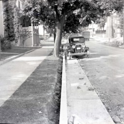
View from the 300 block of S. Main Street, Woodstock, looking north towards the intersection with Spring Street.
St. Paul's United Church of Christ (UCC) Church is visible in the back on the right.
The image highlights what appears to be new…
St. Paul's United Church of Christ (UCC) Church is visible in the back on the right.
The image highlights what appears to be new…
View of Mount Jackson
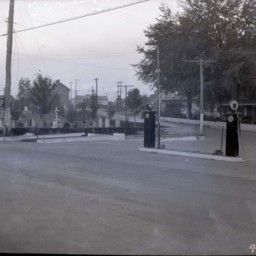
View of Main Street in Mount Jackson Virginia, where it intersects with Orkney Blvd.
The photograph was taken from behind two gas pumps and beside a cemetery.
The photograph was taken from behind two gas pumps and beside a cemetery.
View of Railroad Bridge Over Pugh's Run

View of the covered railroad bridge over Pugh's Run, about two miles north of Woodstock. The photograph was taken looking west from Old Valley Pike (Route 11).