

Browse Items (35 total)
Sort by:
Horseback Riders
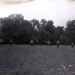
Six unidentified boys on horseback with an adult male also on a horse on the far left.
The photograph was taken in a field with trees in the background.
The photograph was taken in a field with trees in the background.
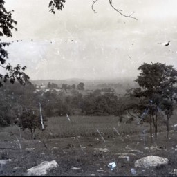
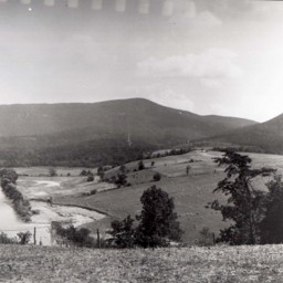
Valley View - Maurertown
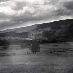
Photograph showing farm, barn, and view of the Massanutten Mountain east of Maurertown Virginia.
The barn pictured on the right still stands at 989 Black Bear Road, Maurertown.
The barn pictured on the right still stands at 989 Black Bear Road, Maurertown.
View Across a Road and Railroad Tracks
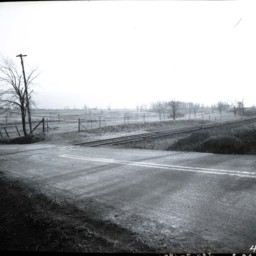
Photograph of an unidentified paved road as it crosses railroad tracks.
Beyond both, only fields, bare trees, fences, and a couple of telephone poles are visible.
Beyond both, only fields, bare trees, fences, and a couple of telephone poles are visible.
View Looking East of Woodstock and MMA Campus
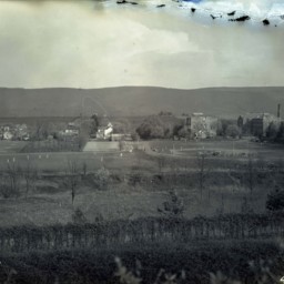
View looking east from Massanutten Heights, of the ball fields and campus buildings of Massanutten Military Academy (MMA).
Route 11 runs on the far side of the buildings and many houses on the southern end of Woodstock are also visible.
Several…
Route 11 runs on the far side of the buildings and many houses on the southern end of Woodstock are also visible.
Several…
Farmer and Boy in a Field
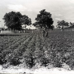
Photograph of an unidentified farmer wearing overalls and a hat is standing beside an unidentified boy in a large field planted in a knee-high, flowering crop.
Man and Boy in a Wheat Field
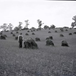
Unidentified farmer with a hat and overalls is standing by a young unidentified boy with curly hair in a field of cut wheat.
Behind them is another man atop a horse-drawn cart loaded with wheat.
This may be located on the Clower Farm near…
Behind them is another man atop a horse-drawn cart loaded with wheat.
This may be located on the Clower Farm near…
Wheat Field and Farm
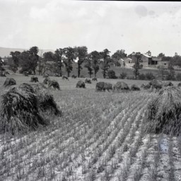
View across a wheat field that has been cut and put in piles awaiting further processing.
The picture shows the Clower farm located near Saumsville Virginia.
The house visible on the left still stands at 1292 Jadwyn Road and the house in the…
The picture shows the Clower farm located near Saumsville Virginia.
The house visible on the left still stands at 1292 Jadwyn Road and the house in the…
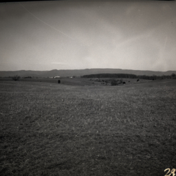
View Across Wheat Field Towards St. Luke
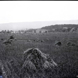
View of the village of St. Luke (west of Woodstock) from across a field of cut wheat.
A store and other buildings are visible.
A store and other buildings are visible.
View of Countryside and Endless Caverns
View of a wide expanse of the Shenandoah Valley across fields and trees.
In the background, you can see the entrance to and parking lot for Endless Caverns near New Market Virginia.
In the background, you can see the entrance to and parking lot for Endless Caverns near New Market Virginia.
Valley View - Basye
Damed image showing a view of the area in western Shenandoah County known as the Happy Valley/Basye community.
Trinity/Powder Springs United Church of Christ and Powder Springs School are visible on a hill close to the center of the photograph as…
Trinity/Powder Springs United Church of Christ and Powder Springs School are visible on a hill close to the center of the photograph as…
View near Edinburg Virginia
Photograph showing a mountain view in the area of what is now the 12000 block of S. Middle Road, Edinburg Virginia.
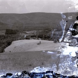
Farms Near Bowmans Crossing

Photograph showing farms near the Bowmans Crossing community looking east toward the Massanutten Mountain.
The Interstate 81 277 Interchange is today located in the center of this photograph. Structures in Bowmans Crossing, including the railroad…
The Interstate 81 277 Interchange is today located in the center of this photograph. Structures in Bowmans Crossing, including the railroad…
Scenic View of an Orchard
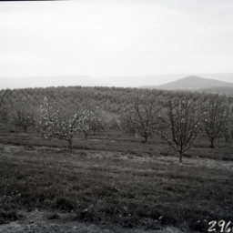
View across rolling fruit tree orchards. Mountains are visible in the distance.
House in a Rural Setting

View of a cape cod-styled home with outbuildings situated in an open area with trees and fields all around it.
Gravel driveway is visible in the foreground.
Gravel driveway is visible in the foreground.
Gravel Driveway and Fencing
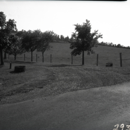
Photograph of a gravel driveway lined with trees. A fenced pasture is visible on one side.
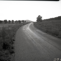
Scenic View
View of Massanutten Mountain from a country road somewhere west of it.
Scenic View
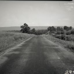
View looking east from a country road somewhere west of Massanutten Mountain.
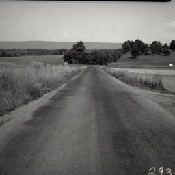
Road View
Scenic view along a country road in Shenandoah County, Virginia. Fields and a hill are visible in the background.
The photograph was taken in the area of 3398 Ridge Road north east of New Market Virginia.
The photograph was taken in the area of 3398 Ridge Road north east of New Market Virginia.
Scenic View of Orchards
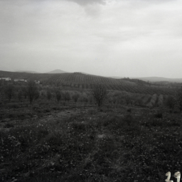
View across rolling fruit tree orchards. Individual mountains and farms are visible in the distance.
Preston W. and Fleeta (McAfee) Scott & Family
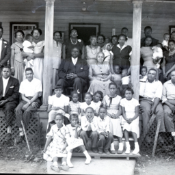
Photograph of Preston W. Scott and his wife, Fleeta Mae (McAfee) Scott, seated on the porch of their home at 120 S. Water Street in Woodstock and surrounded by their children and their families.
Identified are (l to r):
Front row: Unidentified…
Identified are (l to r):
Front row: Unidentified…
Preston W. and Fleeta (McAfee) Scott & Family
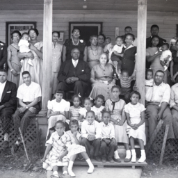
Photograph of Preston W. Scott and his wife, Fleeta Mae (McAfee) Scott, seated on the porch of their home at 120 S. Water Street in Woodstock and surrounded by their children and their families.
Identified are (l to r):
Front row: Unidentified…
Identified are (l to r):
Front row: Unidentified…
Preston W. and Fleeta (McAfee) Scott & Family
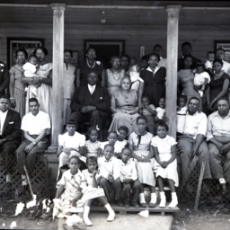
Photograph of Preston W. Scott and his wife, Fleeta Mae (McAfee) Scott, seated on the porch of their home at 120 S. Water Street in Woodstock, and surrounded by their children and their families.
Identified are (l to r):
Front row: Unidentified…
Identified are (l to r):
Front row: Unidentified…
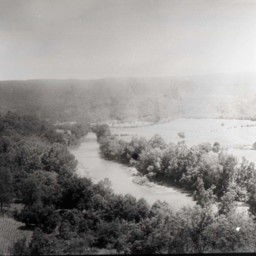
Scenic View
View of the Shenandoah River and Massanutten Mountain near Edinburg Virginia.
The photograph looks west from near Route 11 and overlooks the Edinburg Dam on the North Fork of the Shenandoah River. The Cliffside Estates development (Cliffside…
The photograph looks west from near Route 11 and overlooks the Edinburg Dam on the North Fork of the Shenandoah River. The Cliffside Estates development (Cliffside…
"Lewis Funkhouser's Ford"
Photograph showing the "Ford at Lewis Funkhouser's" with the Massanutten Mountain in the background.
The site is currently occupied by the Lupton Road River Bridge with Seven Bends State Park on the right of the image. Woodstock is immediately…
The site is currently occupied by the Lupton Road River Bridge with Seven Bends State Park on the right of the image. Woodstock is immediately…
Farms Near Bowmans Crossing
Photograph showing farms and houses near the Bowmans Crossing community.
The image looks west and is today home of the 277 interchange for Interstate 81. This would have been known as the Bowman and Richman Farms.
The image looks west and is today home of the 277 interchange for Interstate 81. This would have been known as the Bowman and Richman Farms.