

Browse Items (35719 total)
Sort by:
Sandra (Rickard) Mann
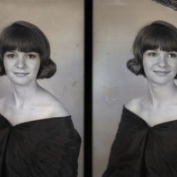
Photo of two separate portrait photographs of Sandra Kay (Rickard) Mann as a young woman with short hair and bangs.
The image on the right was used as Sandra's senior class picture in the 1967 Central High School yearbook (Wings).
Sandra was…
The image on the right was used as Sandra's senior class picture in the 1967 Central High School yearbook (Wings).
Sandra was…
Sandra (Seal) Funk
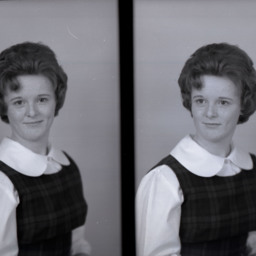
Photo of two separate portrait photographs of Sandra Lee (Seal) Funk as a young woman with short, styled hair and wearing a plaid jumper.
She was a daughter of Davis Lee and Dorothy Irene (Lucas) Seal of Edinburg.
She graduated from Central…
She was a daughter of Davis Lee and Dorothy Irene (Lucas) Seal of Edinburg.
She graduated from Central…
Sandra (Wolverton) White
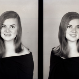
Photo of two separate portrait photographs of Sandra Kay (Wolverton) White as a young woman with shoulder-length, straight hair.
A photograph similar to these was used in the 1969 Central High School yearbook when Sandra was a Senior.
Sandra…
A photograph similar to these was used in the 1969 Central High School yearbook when Sandra was a Senior.
Sandra…
Sandra (Wolverton) White
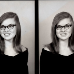
Photo of two separate portrait photographs of Sandra Kay (Wolverton) White as a young woman with straight hair and glasses.
She was the Vice President of her Sophomore class at Central High School in 1967.
Sandra was the daughter of Earl…
She was the Vice President of her Sophomore class at Central High School in 1967.
Sandra was the daughter of Earl…
Sandra (Wolverton) White
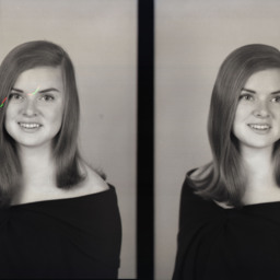
Photo of two separate portrait photographs of Sandra Kay (Wolverton) White as a young woman with shoulder-length, straight hair.
A photograph similar to these was used in the 1969 Central High School yearbook when Sandra was a Senior.
Sandra…
A photograph similar to these was used in the 1969 Central High School yearbook when Sandra was a Senior.
Sandra…
Sandra Good
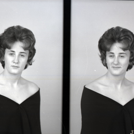
Photo of two separate portrait photographs of Sandra Good as a young woman with short, styled hair and wearing a photographer's drape.
A photograph similar to these was used in the 1964 Stonewall Jackson High School Yearbook (SJHS) titled,…
A photograph similar to these was used in the 1964 Stonewall Jackson High School Yearbook (SJHS) titled,…
Sandra Lee Silcott
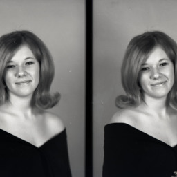
Photo of two separate portrait photographs of Sandra Lee (Silcott) Painter as a young woman with shoulder-length hair curled outwards.
Sandra was the daughter of Paul and Larue Virginia (Rush) Silcott of Edinburg.
An image similar to these was…
Sandra was the daughter of Paul and Larue Virginia (Rush) Silcott of Edinburg.
An image similar to these was…
Sandra Lee Silcott
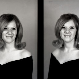
Photo of two separate portrait photographs of Sandra Lee (Silcott) Painter as a young woman with shoulder-length hair curled outwards.
Sandra was the daughter of Paul and Larue Virginia (Rush) Silcott of Edinburg.
An image similar to these was…
Sandra was the daughter of Paul and Larue Virginia (Rush) Silcott of Edinburg.
An image similar to these was…
Sandra Mantz
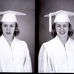
Photo of two portrait photographs of Sandra Mantz in her graduation cap and gown.
Sandra Mantz
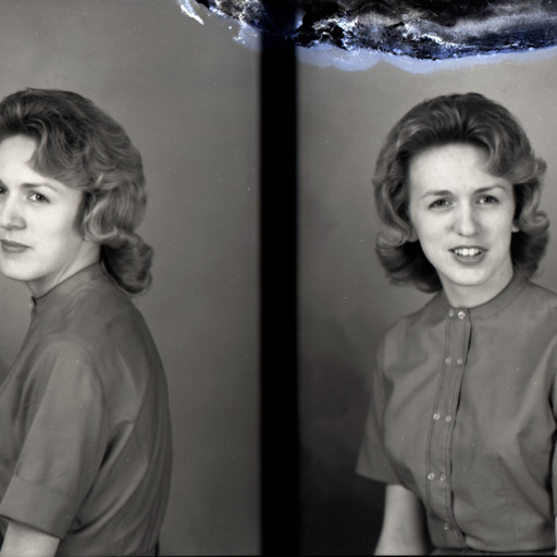
Photo of two separate portrait photographs of Sandra Mantz as a young woman in a short-sleeved dress.
Sandra Mantz
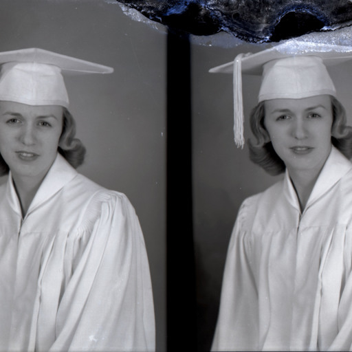
Photo of two separate portrait photographs of Sandra Mantz in her graduation cap and gown.
Sandy (Hawkins) Helsley
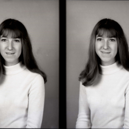
Photo of two separate portrait photographs of Sandy L. (Hawkins) Helsley, as a young woman.
The image on the left has a mark at the top where the photographer has noted which of the two images he planned to print.
Sandy was born to George…
The image on the left has a mark at the top where the photographer has noted which of the two images he planned to print.
Sandy was born to George…
Sandy Coffelt
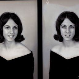
Photo of two separate portrait photographs of Sandy Coffelt as a young woman with short hair curled outwards.
The image on the right has a mark at the top where the photographer noted which of the two images he planned to print.
The image on the right has a mark at the top where the photographer noted which of the two images he planned to print.
Sandy Coffman and Family
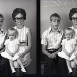
Photo of two separate images of Sandra "Sandy" Coffman with her brother Ronald and sister Holly (Coffman) Hodges.
Sandy is the daughter of Linden Coffman and Alese Selma Coffman. Her mother died when she was young and she raised her two siblings.…
Sandy is the daughter of Linden Coffman and Alese Selma Coffman. Her mother died when she was young and she raised her two siblings.…
Santa Claus Program

Two undated photographs showing an unidentified individual serving as "Santa Claus" for the Shenandoah County Library's annual Christmas holiday program for children. The photographs were taken in the library's original location in the basement of…
Sara Ann Wine

Portrait photograph of Sara Ann Wine with short, styled hair.
She graduated from Woodstock High School in 1946.
She graduated from Woodstock High School in 1946.
Sara Ann Wine

Portrait photograph of Sara Ann Wine as a young woman with short, styled hair.
Sara graduated from Woodstock High School in 1946.
Sara graduated from Woodstock High School in 1946.
Sara Machir

Portrait photograph of Sara Alma Machir.
This photograph appeared in the 1925 Strasburg High School yearbook "Shenandoah." Sara graduated from the high school that year and the yearbook notes her nickname was "Daughter."
This photograph appeared in the 1925 Strasburg High School yearbook "Shenandoah." Sara graduated from the high school that year and the yearbook notes her nickname was "Daughter."